
ملف:Houston Ship Channel Barbours Cut.jpg

حجم هذه المعاينة: 800 × 534 بكسل. الأبعاد الأخرى: 320 × 214 بكسل | 640 × 427 بكسل | 1٬024 × 683 بكسل | 1٬500 × 1٬001 بكسل.
الملف الأصلي (1٬500 × 1٬001 بكسل حجم الملف: 693 كيلوبايت، نوع MIME: image/jpeg)
| هذا ملف من ويكيميديا كومنز. معلومات من صفحة وصفه مبينة في الأسفل. كومنز مستودع ملفات ميديا ذو رخصة حرة. |
| الوصف |
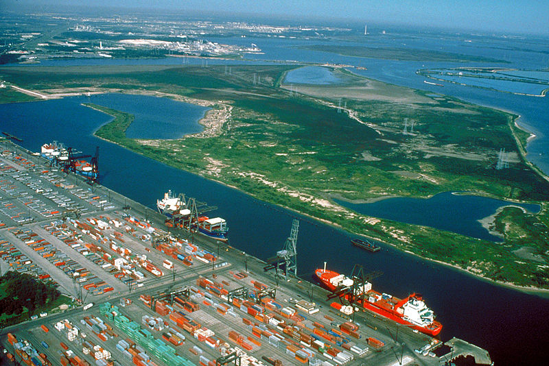
English: Aerial view of the Barbour's Cut area on the Houston Ship Channel in Houston, Texas, USA. This area is a large container terminal. This photograph appears to have been taken before the Fred Hartman Bridge was built, or when the bridge was under construction. In a present-day photograph, the bridge should be clearly visible at top right.
Coordinates: 29°40′54.98″N 94°59′54.37″W / 29.6819389°N 94.9984361°W |
|||
| الموقع | Houston, Texas, USA | |||
| التاريخ | Probably pre-1995 | |||
| المصدر |
U.S. Army Corps of Engineers Digital Visual Library Image page Image description page Digital Visual Library home page |
|||
| المؤلف | U.S. Army Corps of Engineers, photographer not specified or unknown | |||
| الترخيص (إعادة استخدام هذا الملف) |
|
تاريخ الملف
اضغط على زمن/تاريخ لرؤية الملف كما بدا في هذا الزمن.
| زمن/تاريخ | صورة مصغرة | الأبعاد | مستخدم | تعليق | |
|---|---|---|---|---|---|
| حالي | 01:22، 10 مايو 2007 | | 1٬500 × 1٬001 (693 كيلوبايت) | DanMS | {{Information | Description = {{en|Aerial view of the Barbour's Cut area on the Houston Ship Channel in Houston, Texas, USA. This area is a large container terminal. This photograph appears to have been taken before the Fred Hartman Bridge was built, o |
استخدام الملف
الصفحتان التاليتان تستخدمان هذا الملف:
الاستخدام العالمي للملف
الويكيات الأخرى التالية تستخدم هذا الملف:
- الاستخدام في bn.wikipedia.org
- الاستخدام في de.wikipedia.org
- الاستخدام في en.wikipedia.org
- الاستخدام في es.wikipedia.org
- الاستخدام في eu.wikipedia.org
- الاستخدام في fi.wikipedia.org
- الاستخدام في fr.wikipedia.org
- الاستخدام في gu.wikipedia.org
- الاستخدام في hu.wikipedia.org
- الاستخدام في it.wikipedia.org
- الاستخدام في ja.wikipedia.org
- الاستخدام في lt.wikipedia.org
- الاستخدام في ml.wikipedia.org
- الاستخدام في nl.wikipedia.org
- الاستخدام في no.wikipedia.org
- الاستخدام في pl.wikipedia.org
- الاستخدام في pnb.wikipedia.org
- الاستخدام في pt.wikipedia.org
- الاستخدام في ru.wikipedia.org
- الاستخدام في te.wikipedia.org
- الاستخدام في tr.wikipedia.org
- الاستخدام في uk.wikipedia.org
- الاستخدام في ur.wikipedia.org
- الاستخدام في uz.wikipedia.org
- الاستخدام في vi.wikipedia.org
- الاستخدام في www.wikidata.org
- الاستخدام في zh-min-nan.wikipedia.org
اعرض المزيد من الاستخدام العام لهذا الملف.