
ملف:Northern Gulf of Mexico map.png

حجم هذه المعاينة: 800 × 486 بكسل. الأبعاد الأخرى: 320 × 194 بكسل | 640 × 389 بكسل | 1٬024 × 622 بكسل | 1٬280 × 778 بكسل | 2٬526 × 1٬535 بكسل.
الملف الأصلي (2٬526 × 1٬535 بكسل حجم الملف: 306 كيلوبايت، نوع MIME: image/png)
| هذا ملف من ويكيميديا كومنز. معلومات من صفحة وصفه مبينة في الأسفل. كومنز مستودع ملفات ميديا ذو رخصة حرة. |
| الوصف |
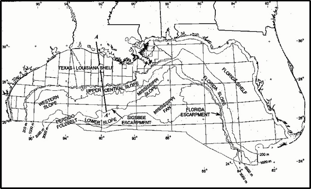
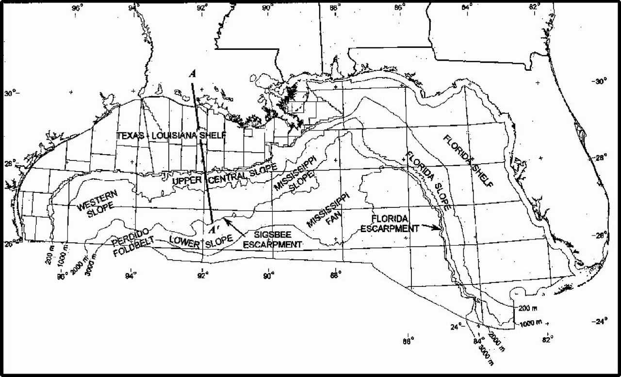
English: Map of northern part of Gulf of Mexico. Major physiogeograaphic features of the northern part of Gulf of Mexico outer continental shelf. |
| التاريخ | |
| المصدر | Minerals Management Service. Gulf of Mexico OCS Region. (May 2000). Gulf of Mexico Deepwater Operations and Activities. Environmental Assessment. U.S. Department of the Interior, Minerals Management Service, Gulf of Mexico OCS Region, New Orleans. Figure III-1. |
| المؤلف | Minerals Management Service. Gulf of Mexico OCS Region |
| This article or image contains material based on a work of a Minerals Management Service employee, created as part of that person's official duties. As a work of the U.S. federal government, such work is in the public domain in the United States. See MMS Disclaimer. |  |
تاريخ الملف
اضغط على زمن/تاريخ لرؤية الملف كما بدا في هذا الزمن.
| زمن/تاريخ | صورة مصغرة | الأبعاد | مستخدم | تعليق | |
|---|---|---|---|---|---|
| حالي | 19:38، 4 مايو 2010 | | 2٬526 × 1٬535 (306 كيلوبايت) | Snek01 | {{Information |Description={{en|Map of northern part of Gulf of Mexico. Major physiogeograaphic features of the northern part of Gulf of Mexico outer continental shelf.}} |Source=Minerals Management Service. Gulf of Mexico OCS Region. (May 2000). ''Gulf o |
استخدام الملف
الصفحة التالية تستخدم هذا الملف:
الاستخدام العالمي للملف
الويكيات الأخرى التالية تستخدم هذا الملف:
- الاستخدام في en.wikipedia.org