
ملف:Parthia 001ad.jpg
الملف الأصلي (793 × 652 بكسل حجم الملف: 741 كيلوبايت، نوع MIME: image/jpeg)
| هذا ملف من ويكيميديا كومنز. معلومات من صفحة وصفه مبينة في الأسفل. كومنز مستودع ملفات ميديا ذو رخصة حرة. |

|
هذه historical map الصورة / الصورتان باستعمال رسومات متجهية ملفات رسوميات شعاعية.
It is recommended to name the SVG file "Parthia 001ad.svg" - then the template Vector version available (or Vva) does not need the new image name parameter.
|


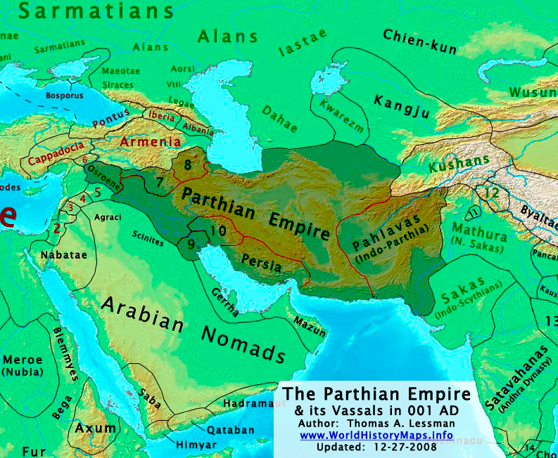
| الوصف | The Parthian Empire in 001 AD. |
| التاريخ | |
| المصدر | عمل شخصي; derived from (1) John Nelson. Interactive Historical Atlas of the World. Map of "Countries of the World 1/1/001 CE" and (2) Encyclopaedia Iranica, their article about the Parthians. |
| المؤلف | Thomas Lessman (Contact!) |
| الترخيص (إعادة استخدام هذا الملف) |
هذا الملف مُرخص تحت رخصة المشاع المبدع نسبة المصنف إلى مؤلفه 3.0 العامة
|
| إصدارات أخرى | see below, العربيَّة |
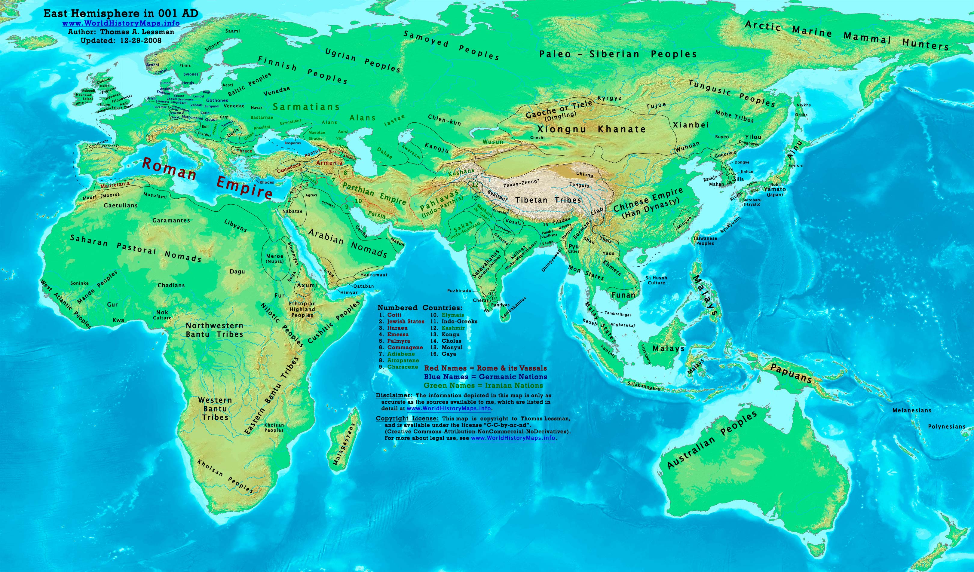
Map Summary

Original Source URL: http://www.worldhistorymaps.info/images/East-Hem_001ad.jpg
This map is a zoomed-in version of Thomas Lessman's map of the
East-Hem_001ad.jpg (also available at www.WorldHistoryMaps.info).
The highlighted areas represent the Parthian Empire and its vassal kingdoms in the year 1 AD.
Map Source References
Remember, sources often conflict with each other. This map is only as accurate as the information that is available to me. To report any errors or to help further this work, please click here, or email Thomas Lessman at talessman@yis.us
References for information contained in this map:
Other Maps by Thomas Lessman
| Maps of the eastern hemisphere showing history
Bold dates are available on Wikimedia or Wikipedia. | ||
| Primeval | ||
| Ancient
|
·| 600 BC | 550 BC | 527 BC | 500 BC |
400 BC | ·| 1 AD | 50 AD | 100 AD | 200 AD | 300 AD | | |
| Medieval |
·| 500 AD | 565 AD | 600 AD | 700 AD | | |
| Modern |
·| 1500 AD | · * For historical maps of the whole world, | |
Other Info
تاريخ الملف
اضغط على زمن/تاريخ لرؤية الملف كما بدا في هذا الزمن.
| زمن/تاريخ | صورة مصغرة | الأبعاد | مستخدم | تعليق | |
|---|---|---|---|---|---|
| حالي | 02:09، 29 ديسمبر 2008 | | 793 × 652 (741 كيلوبايت) | Talessman | Category:Maps of the history of Iran |
| 21:37، 16 مايو 2008 |  | 1٬025 × 677 (771 كيلوبايت) | Talessman | Improved border appearance, corrected eastern borders of Parthia, other corrections explained on the [http://commons.wikimedia.org/wiki/Image:East-Hem_001ad.jpg East-Hem_001ad.jpg] description page. | |
| 22:51، 9 مايو 2008 |  | 1٬022 × 854 (286 كيلوبايت) | Talessman | {{Information |Description='''<big>The [http://en.wikipedia.org/wiki/Parthian_Empire Parthian Empire] in 001 AD.'''</big> |Source=Self-made |Author=Thomas Lessman (Contact!) |Permission={{self|cc-by-sa-3.0}} }} |
استخدام الملف
الصفحتان التاليتان تستخدمان هذا الملف:
الاستخدام العالمي للملف
الويكيات الأخرى التالية تستخدم هذا الملف:
- الاستخدام في af.wikipedia.org
- الاستخدام في an.wikipedia.org
- الاستخدام في av.wikipedia.org
- الاستخدام في azb.wikipedia.org
- الاستخدام في az.wikipedia.org
- الاستخدام في ba.wikipedia.org
- الاستخدام في be.wikipedia.org
- الاستخدام في bg.wikipedia.org
- الاستخدام في ca.wikipedia.org
- الاستخدام في ceb.wikipedia.org
- الاستخدام في ckb.wikipedia.org
- الاستخدام في cs.wikipedia.org
- الاستخدام في da.wikipedia.org
- الاستخدام في de.wikipedia.org
- الاستخدام في el.wikipedia.org
- الاستخدام في en.wikipedia.org
- الاستخدام في es.wikipedia.org
- الاستخدام في fa.wikipedia.org
- الاستخدام في fr.wikipedia.org
اعرض المزيد من الاستخدام العام لهذا الملف.