
ملف:115th United States Congress Congressional Districts.pdf
حجم معاينة JPG لذلك الملف ذي الامتداد PDF: 800 × 593 بكسل. الأبعاد الأخرى: 320 × 237 بكسل | 640 × 475 بكسل | 1٬024 × 759 بكسل | 1٬280 × 949 بكسل | 2٬560 × 1٬898 بكسل | 6٬675 × 4٬950 بكسل.
الملف الأصلي (6٬675 × 4٬950 بكسل حجم الملف: 18٫44 ميجابايت، نوع MIME: application/pdf)
| هذا ملف من ويكيميديا كومنز. معلومات من صفحة وصفه مبينة في الأسفل. كومنز مستودع ملفات ميديا ذو رخصة حرة. |
| الوصف |
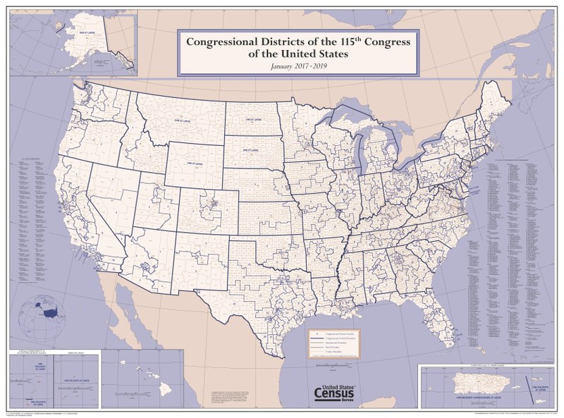
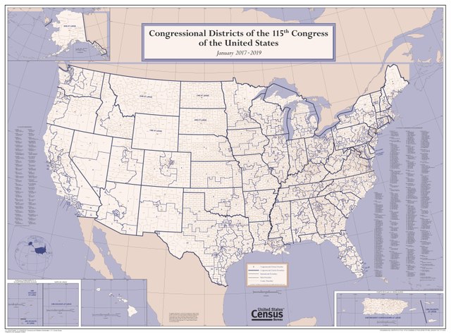
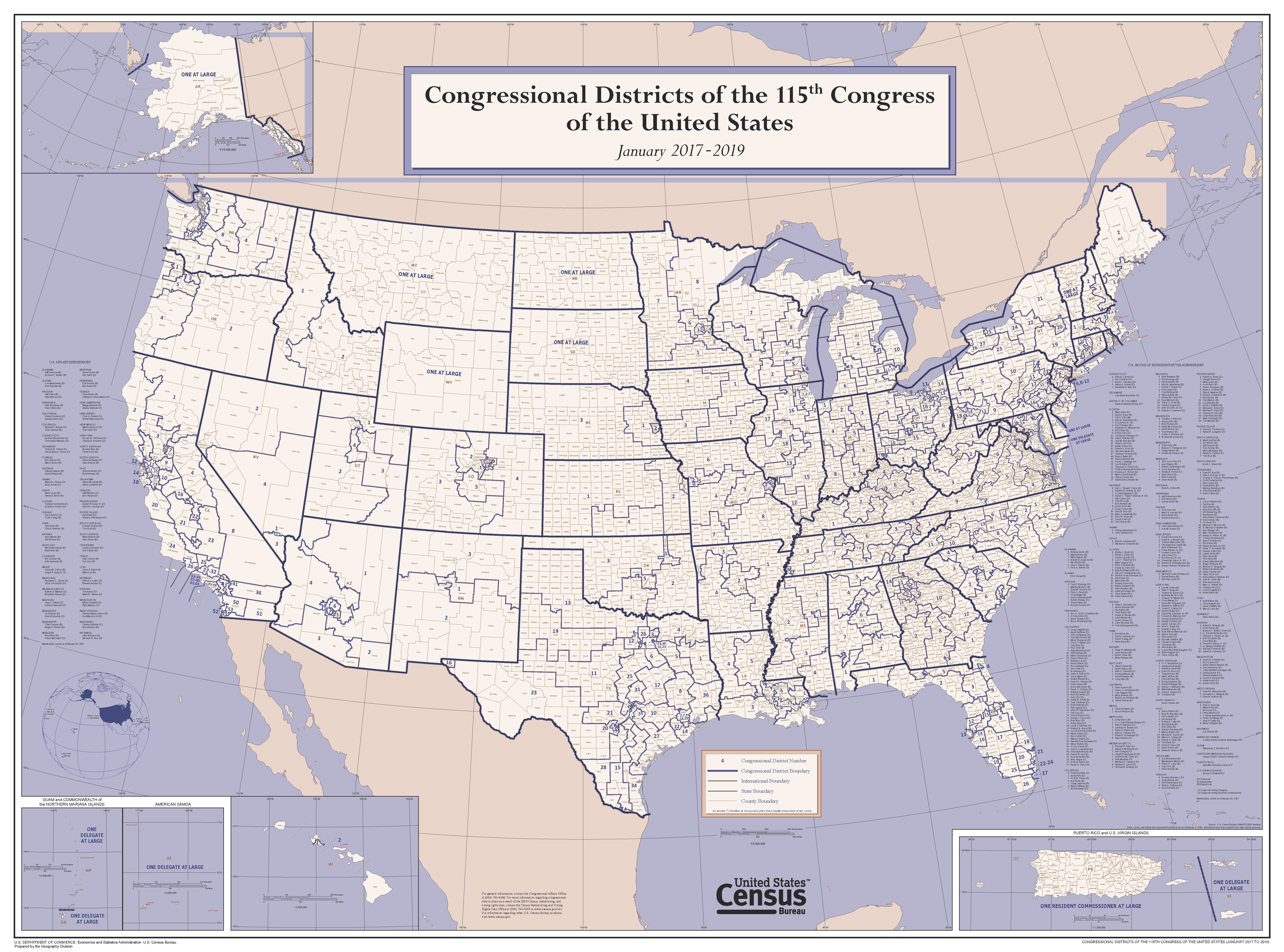
English: This wall map depicts congressional district boundaries in effect for the 115th Congress of the United States (January 2017-2019). The map includes county names and boundaries for each state, the District of Columbia, Puerto Rico, American Samoa, Guam, the Commonwealth of the Northern Mariana Islands, and U.S. Virgin Islands. The map also includes a listing of the names of all members of the 115th Congress, as of January 10, 2017. |
|||
| التاريخ | ||||
| المصدر | https://www2.census.gov/geo/maps/cong_dist/uswall/cd115/CD115_US_WallMap.pdf | |||
| المؤلف | U.S. Census Bureau | |||
| الترخيص (إعادة استخدام هذا الملف) |
|

تاريخ الملف
اضغط على زمن/تاريخ لرؤية الملف كما بدا في هذا الزمن.
| زمن/تاريخ | صورة مصغرة | الأبعاد | مستخدم | تعليق | |
|---|---|---|---|---|---|
| حالي | 04:02، 27 سبتمبر 2017 |  | 6٬675 × 4٬950 (18٫44 ميجابايت) | Kingofthedead | {{Information |Description ={{en|1=This wall map depicts congressional district boundaries in effect for the 115th Congress of the United States (January 2017-2019). The map includes county names and boundaries for each state, the District of Columb... |
استخدام الملف
الصفحة التالية تستخدم هذا الملف:
الاستخدام العالمي للملف
الويكيات الأخرى التالية تستخدم هذا الملف:
- الاستخدام في en.wikipedia.org
- الاستخدام في nl.wikipedia.org
- الاستخدام في zh.wikipedia.org