
ملف:Bayou La Batre harbor aerial view.jpg

حجم هذه المعاينة: 800 × 533 بكسل. الأبعاد الأخرى: 320 × 213 بكسل | 640 × 427 بكسل | 1٬024 × 683 بكسل | 1٬500 × 1٬000 بكسل.
الملف الأصلي (1٬500 × 1٬000 بكسل حجم الملف: 796 كيلوبايت، نوع MIME: image/jpeg)
| هذا ملف من ويكيميديا كومنز. معلومات من صفحة وصفه مبينة في الأسفل. كومنز مستودع ملفات ميديا ذو رخصة حرة. |
| الوصف |
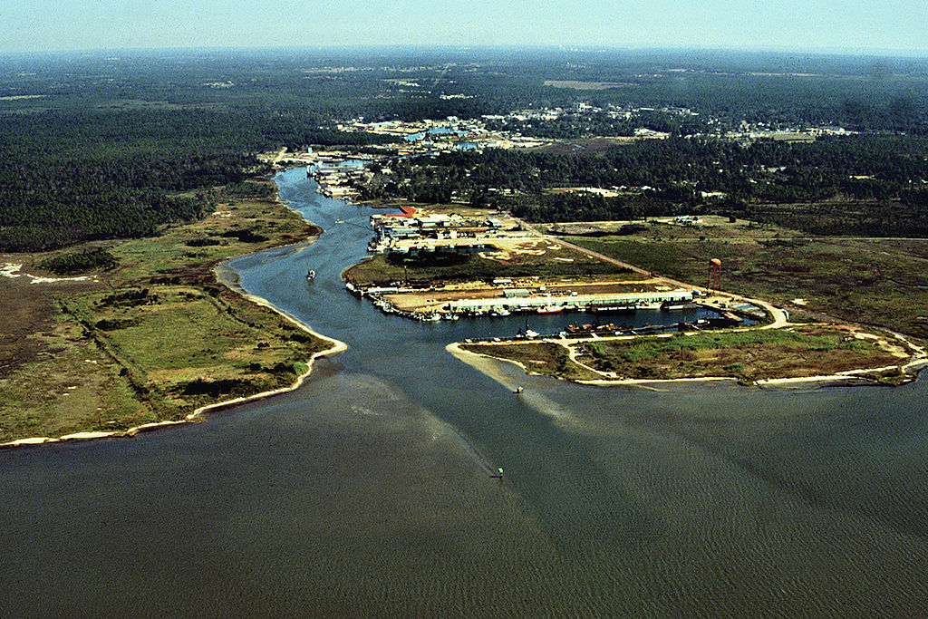
English: Aerial view of the harbor entrance from the Gulf of Mexico at Bayou La Batre, Alabama, USA. View is to the northwest.
Coordinates: 30°23′1.27″N 88°16′16″W / 30.3836861°N 88.27111°W |
|||
| الموقع | Bayou La Batre, Alabama, USA | |||
| التاريخ | (Caveat: Dates provided by U.S. Army Corps of Engineers Digital Visual Library are not reliable and are often wrong.) | |||
| المصدر |
U.S. Army Corps of Engineers Digital Visual Library Image page Image description page Digital Visual Library home page |
|||
| المؤلف | Adrien Lamarre, U.S. Army Corps of Engineers | |||
| الترخيص (إعادة استخدام هذا الملف) |
|
تاريخ الملف
اضغط على زمن/تاريخ لرؤية الملف كما بدا في هذا الزمن.
| زمن/تاريخ | صورة مصغرة | الأبعاد | مستخدم | تعليق | |
|---|---|---|---|---|---|
| حالي | 05:06، 28 أبريل 2007 | | 1٬500 × 1٬000 (796 كيلوبايت) | DanMS | {{Information | Description = {{en|Aerial view of the harbor entrance from the Gulf of Mexico at Bayou La Batre, Alabama, USA. View is to the northwest.}} Coordinates: {{Coor dms|30|23|1.27|N|88|16|16|W|type:city|display=inline}} | Source = U.S |
استخدام الملف
الصفحة التالية تستخدم هذا الملف:
الاستخدام العالمي للملف
الويكيات الأخرى التالية تستخدم هذا الملف:
- الاستخدام في arz.wikipedia.org
- الاستخدام في ca.wikipedia.org
- الاستخدام في ceb.wikipedia.org
- الاستخدام في ce.wikipedia.org
- الاستخدام في cy.wikipedia.org
- الاستخدام في da.wikipedia.org
- الاستخدام في de.wikipedia.org
- الاستخدام في de.wikivoyage.org
- الاستخدام في en.wikipedia.org
- الاستخدام في es.wikipedia.org
- الاستخدام في eu.wikipedia.org
- الاستخدام في fr.wikipedia.org
- الاستخدام في ht.wikipedia.org
- الاستخدام في hu.wikipedia.org
- الاستخدام في io.wikipedia.org
- الاستخدام في it.wikipedia.org
- الاستخدام في lld.wikipedia.org
- الاستخدام في no.wikipedia.org
- الاستخدام في pl.wikipedia.org
- الاستخدام في pt.wikipedia.org
- الاستخدام في sh.wikipedia.org
- الاستخدام في sr.wikipedia.org
- الاستخدام في tt.wikipedia.org
- الاستخدام في uk.wikipedia.org
- الاستخدام في uz.wikipedia.org
- الاستخدام في vi.wikipedia.org
- الاستخدام في www.wikidata.org
- الاستخدام في zh-min-nan.wikipedia.org