
ملف:Debris-GEO1280 p.jpg
الملف الأصلي (1٬280 × 1٬280 بكسل حجم الملف: 146 كيلوبايت، نوع MIME: image/jpeg)
| هذا ملف من ويكيميديا كومنز. معلومات من صفحة وصفه مبينة في الأسفل. كومنز مستودع ملفات ميديا ذو رخصة حرة. |
ملخص
| الوصف |
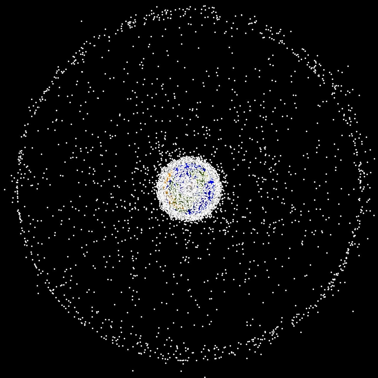
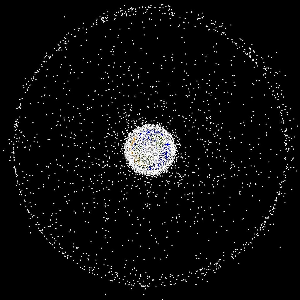
English: Debris plot by NASA The following graphics are computer generated images of objects in Earth orbit that are currently being tracked. Approximately 95% of the objects in this illustration are orbital debris, i.e., not functional satellites. The dots represent the current location of each item. The orbital debris dots are scaled according to the image size of the graphic to optimize their visibility and are not scaled to Earth. These images provide a good visualization of where the greatest orbital debris populations exist. Below are the graphics generated from different observation points. |
| المصدر | http://orbitaldebris.jsc.nasa.gov/photogallery/beehives.html |
| المؤلف | NASA |
ترخيص
| يقع هذا العمل في النِّطاق العامّ في الولايات المُتحدة الأمريكيَّة لأَنَّه عملٌ خالِصٌ من إِنتاج وكالة الفضاء الأمريكيَّة. تنصُ حقوق التَّأليف والنَّشر الخاصَّة بوكالة الفضاء الأمريكيَّة على أنَّ "أعمال الوكالة غير مَحميَّة بحقوق التَّأليف والنَّشر ما لم يُذكر خلافُ ذلك". لمزيدٍ من المعلومات انظر القالِب {{PD-USGov}} وصفحة حقوق التَّأليف والنَّشر الخاصَّة بالوكالة وصفحة سياسة الصُّور الخاصَّة بمُختبر الدَّفع النَّفَّاث. | ||
 |
تنبيهات:
|
تاريخ الملف
اضغط على زمن/تاريخ لرؤية الملف كما بدا في هذا الزمن.
| زمن/تاريخ | صورة مصغرة | الأبعاد | مستخدم | تعليق | |
|---|---|---|---|---|---|
| حالي | 16:47، 1 فبراير 2005 | | 1٬280 × 1٬280 (146 كيلوبايت) | Srbauer | debris plot by NASA |
استخدام الملف
الصفحة التالية تستخدم هذا الملف:
الاستخدام العالمي للملف
الويكيات الأخرى التالية تستخدم هذا الملف:
- الاستخدام في af.wikipedia.org
- الاستخدام في af.wiktionary.org
- الاستخدام في de.wikipedia.org
- الاستخدام في hu.wikipedia.org
- الاستخدام في it.wikipedia.org
- الاستخدام في lb.wikipedia.org
- الاستخدام في pt.wikipedia.org
- الاستخدام في ru.wikipedia.org
- الاستخدام في simple.wikipedia.org
- الاستخدام في sv.wikipedia.org
- الاستخدام في sw.wikipedia.org