
ملف:Fairfax County Virginia Incorporated and Unincorporated Areas Fairfax highlighted.svg

حجم معاينة PNG لذلك الملف ذي الامتداد SVG: 500 × 550 بكسل. الأبعاد الأخرى: 218 × 240 بكسل | 436 × 480 بكسل | 698 × 768 بكسل | 931 × 1٬024 بكسل | 1٬862 × 2٬048 بكسل.
الملف الأصلي (ملف SVG، أبعاده 500 × 550 بكسل، حجم الملف: 228 كيلوبايت)
| هذا ملف من ويكيميديا كومنز. معلومات من صفحة وصفه مبينة في الأسفل. كومنز مستودع ملفات ميديا ذو رخصة حرة. |
ملخص
| الوصف |
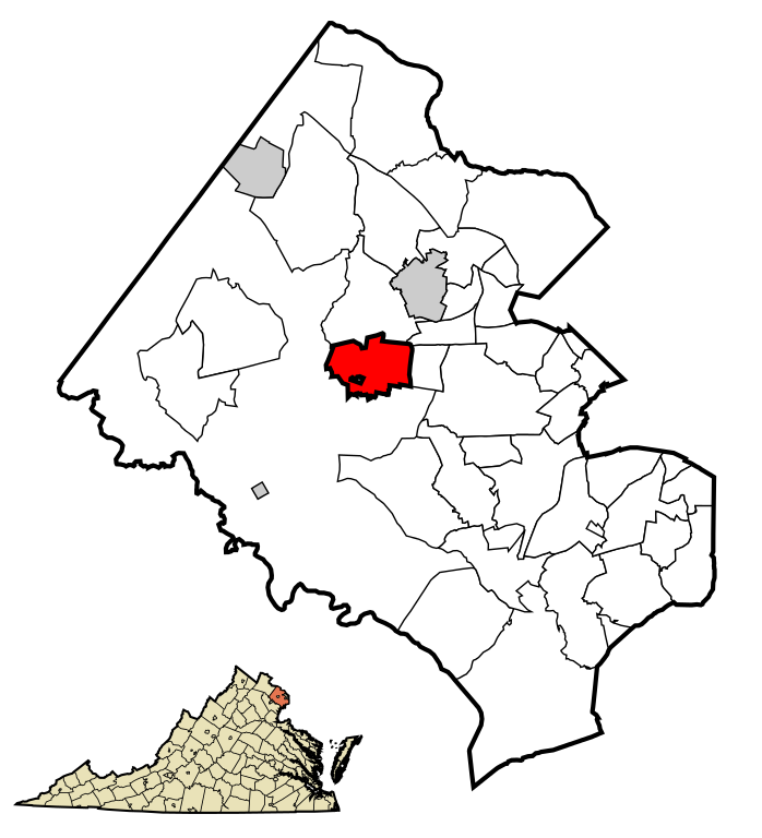
English: This map shows the incorporated areas and unincorporated areas in Fairfax County, Virginia. Fairfax is highlighted in red. Other incorporated cities are shown in gray and CDPs in white.
Please note: The City of Fairfax is an independent city in Virginia, politically independent from the rest of Fairfax County. It is included in this map to show its location relative to the surrounding cities and CDPs in Fairfax County. Map data is based on the following files as noted:
|
| التاريخ | |
| المصدر | My own work, based on public domain information |
| المؤلف | Ixnayonthetimmay |
| SVG منشأ الملف | .هذا الرسم المتجهي أُنشئ بواسطة أنشأه Ixnayonthetimmay Inkscape |
ترخيص
| أنا، مالِك حقوق تأليف ونشر هذا العمل، أجعله في النِّطاق العامِّ، يسري هذا في أرجاء العالم كلِّه. في بعض البلدان، قد يكون هذا التَّرخيص غيرَ مُمكنٍ قانونيَّاً، في هذه الحالة: أمنح الجميع حق استخدام هذا العمل لأي غرض دون أي شرط ما لم يفرض القانون شروطًا إضافية. |
تاريخ الملف
اضغط على زمن/تاريخ لرؤية الملف كما بدا في هذا الزمن.
| زمن/تاريخ | صورة مصغرة | الأبعاد | مستخدم | تعليق | |
|---|---|---|---|---|---|
| حالي | 01:30، 25 نوفمبر 2009 | | 500 × 550 (228 كيلوبايت) | Ixnayonthetimmay | == Summary == {{Information |Description=This map shows the incorporated areas and unincorporated areas in Fairfax County, Virginia. [[:en:Fairfax, Virginia |
استخدام الملف
الصفحة التالية تستخدم هذا الملف:
الاستخدام العالمي للملف
الويكيات الأخرى التالية تستخدم هذا الملف:
- الاستخدام في ang.wikipedia.org
- الاستخدام في arz.wikipedia.org
- الاستخدام في ceb.wikipedia.org
- الاستخدام في eu.wikipedia.org
- الاستخدام في fa.wikipedia.org
- الاستخدام في fr.wikipedia.org
- الاستخدام في ht.wikipedia.org
- الاستخدام في hu.wikipedia.org
- الاستخدام في it.wikipedia.org
- الاستخدام في ro.wikipedia.org
- الاستخدام في sh.wikipedia.org
- الاستخدام في sr.wikipedia.org
- الاستخدام في tt.wikipedia.org
- الاستخدام في ur.wikipedia.org
- الاستخدام في vo.wikipedia.org
- الاستخدام في www.wikidata.org