
ملف:IFR low altitude enroute chart Washington D.C area.tif

حجم معاينة JPG لذلك الملف ذي الامتداد TIF: 749 × 599 بكسل. الأبعاد الأخرى: 300 × 240 بكسل | 600 × 480 بكسل | 960 × 768 بكسل | 1٬280 × 1٬024 بكسل | 2٬560 × 2٬048 بكسل | 5٬626 × 4٬501 بكسل.
الملف الأصلي (5٬626 × 4٬501 بكسل حجم الملف: 10٫12 ميجابايت، نوع MIME: image/tiff)
| هذا ملف من ويكيميديا كومنز. معلومات من صفحة وصفه مبينة في الأسفل. كومنز مستودع ملفات ميديا ذو رخصة حرة. |
ملخص
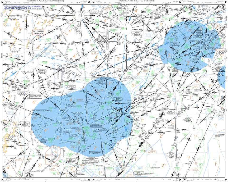
| الوصف | This low altitude section chart is issued for use in air navigation under en:Instrument Flight Rules. The dimensions of this depicted area around Washington D.C. are nearly 280 and 220 nautical miles. |
| التاريخ | |
| المصدر | This is a derivative work originated from a chart package issued by the Federal Aviation Administration. The following changes were made: extracted pages D to F, title strip, "NOT FOR REAL" tag for safety. |
| المؤلف | User:Orion 8 |
ترخيص
This image or file is a work of a Federal Aviation Administration employee, taken or made as part of that person's official duties. As a work of the U.S. federal government, the image is in the public domain in the United States.
|
 |
تاريخ الملف
اضغط على زمن/تاريخ لرؤية الملف كما بدا في هذا الزمن.
| زمن/تاريخ | صورة مصغرة | الأبعاد | مستخدم | تعليق | |
|---|---|---|---|---|---|
| حالي | 21:22، 7 نوفمبر 2013 |  | 5٬626 × 4٬501 (10٫12 ميجابايت) | Orion 8 | {{Information |Description= - |Source= |Date= |Author= |Permission= |other_versions= }} |
استخدام الملف
الصفحة التالية تستخدم هذا الملف:
الاستخدام العالمي للملف
الويكيات الأخرى التالية تستخدم هذا الملف:
- الاستخدام في hu.wikipedia.org