
ملف:ISS-30 Lake Fitri, Chad.jpg
حجم هذه المعاينة: 800 × 531 بكسل. الأبعاد الأخرى: 320 × 213 بكسل | 640 × 425 بكسل | 1٬024 × 680 بكسل | 1٬280 × 850 بكسل | 2٬560 × 1٬700 بكسل | 4٬288 × 2٬848 بكسل.
الملف الأصلي (4٬288 × 2٬848 بكسل حجم الملف: 6٫37 ميجابايت، نوع MIME: image/jpeg)
| هذا ملف من ويكيميديا كومنز. معلومات من صفحة وصفه مبينة في الأسفل. كومنز مستودع ملفات ميديا ذو رخصة حرة. |
ملخص
| الوصف |
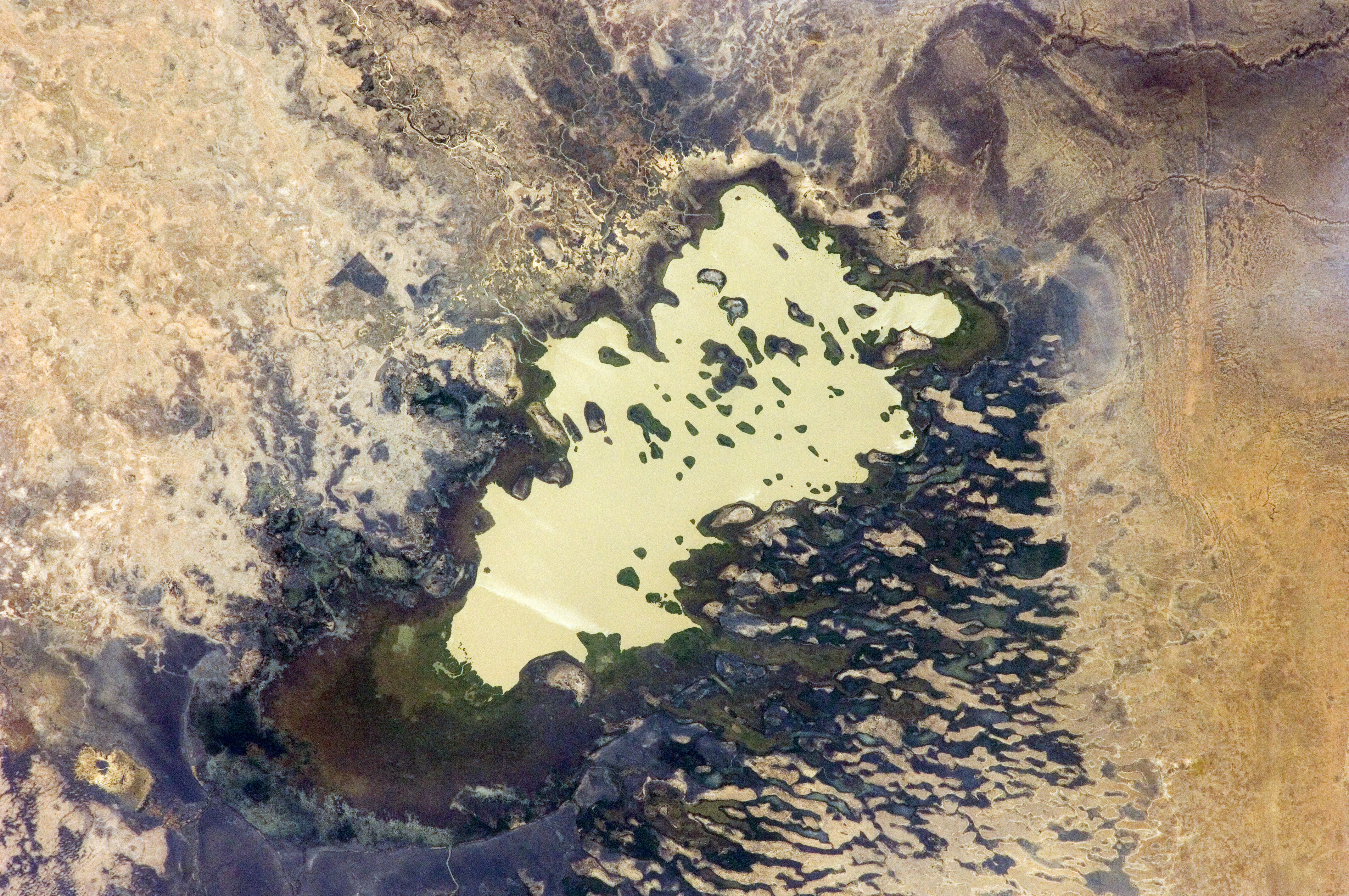
English: Lake Fitri, Chad is featured in this image photographed by an Expedition 30 crew member on the International Space Station.
|
| التاريخ | |
| المصدر | http://spaceflight.nasa.gov/gallery/images/station/crew-30/html/iss030e059398.html |
| المؤلف | NASA |
فُهرِست هذه الصُّورة أَو هذا التَّسجيل المرئي لدى مركز جونسون للفضاء التَّابعة لوكالة الفضاء الأَمريكيَّة (ناسا) تحت المُعرِّف ISS030-E-059398. لا يُشير هذه الوَسم إلى حالة حقوق التَّأليف والنَّشر الخاصَّة بالعمل المُرفَق؛ لا يزال وَسم حقوق التَّأليف والنَّشر مَطلُوباً، راجع كومنز:ترخيص لمزيدٍ من المعلومات. لغات أخرى:
|
ترخيص
يقع هذا الملفُّ في النِّطاق العامِّ في الولايات المُتحدة لأنَّه أُنشِئ مِن قبل مُختبر علوم الصُّور وتحليلها في مركز جُونسُون للفضاء التَّابِع لوَكالة الفضاء الأَمريكيَّة. تنصُّ سياسة حقوق التَّأليف والنَّشر لوَكالة الفضاء الأَمريكيَّة على أنَّ "المواد الَّتي تُنتجها الوَكالة غير مَحميَّةٍ بحقوق التَّأليف والنَّشر ما لم يُذكر خلاف ذلك". انظر (دليل استعمال الوسائِط الخاصِّ بالوَكالة أو شروط استعمال الصُّور الضُّوئِيَّة التي التقطها روَّاد الفضاء).
مَصدَر الصُّورة: ISS030-E-59398.
|
تاريخ الملف
اضغط على زمن/تاريخ لرؤية الملف كما بدا في هذا الزمن.
| زمن/تاريخ | صورة مصغرة | الأبعاد | مستخدم | تعليق | |
|---|---|---|---|---|---|
| حالي | 20:00، 20 أبريل 2016 | | 4٬288 × 2٬848 (6٫37 ميجابايت) | Ras67 | new rendered in high quality from NASA's raw image data |
| 12:46، 4 يونيو 2012 |  | 4٬288 × 2٬848 (2٫03 ميجابايت) | Ras67 | levels | |
| 17:59، 21 فبراير 2012 |  | 4٬288 × 2٬848 (1٫76 ميجابايت) | Ras67 | {{Information |Description ={{en|1=Lake Fitri, Chad is featured in this image photographed by an Expedition 30 crew member on the International Space Station. Lake Fitri is an endorheic, or terminal lake in a desert basin in the southern Sahara Desert. |
استخدام الملف
الصفحة التالية تستخدم هذا الملف:
الاستخدام العالمي للملف
الويكيات الأخرى التالية تستخدم هذا الملف:
- الاستخدام في arz.wikipedia.org
- الاستخدام في be.wikipedia.org
- الاستخدام في cv.wikipedia.org
- الاستخدام في de.wikipedia.org
- الاستخدام في el.wikipedia.org
- الاستخدام في en.wikipedia.org
- الاستخدام في es.wikipedia.org
- الاستخدام في fr.wikipedia.org
- الاستخدام في id.wikipedia.org
- الاستخدام في it.wikipedia.org
- الاستخدام في ka.wikipedia.org
- الاستخدام في lt.wikipedia.org
- الاستخدام في my.wikipedia.org
- الاستخدام في nl.wikipedia.org
- الاستخدام في pl.wikipedia.org
- الاستخدام في ru.wikipedia.org
- الاستخدام في uk.wikipedia.org
- الاستخدام في vi.wikipedia.org
- الاستخدام في www.wikidata.org