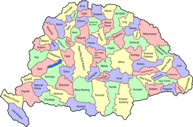
ملف:Kingdom of Hungary counties-2.svg
المظهر

حجم معاينة PNG لذلك الملف ذي الامتداد SVG: 779 × 513 بكسل. الأبعاد الأخرى: 320 × 211 بكسل | 640 × 421 بكسل | 1٬024 × 674 بكسل | 1٬280 × 843 بكسل | 2٬560 × 1٬686 بكسل.
الملف الأصلي (ملف SVG، أبعاده 779 × 513 بكسل، حجم الملف: 265 كيلوبايت)
تاريخ الملف
اضغط على زمن/تاريخ لرؤية الملف كما بدا في هذا الزمن.
| زمن/تاريخ | صورة مصغرة | الأبعاد | مستخدم | تعليق | |
|---|---|---|---|---|---|
| حالي | 17:57، 5 ديسمبر 2009 |  | 779 × 513 (265 كيلوبايت) | SimonTrew | I missed some fixes of Veszprém |
| 17:55، 5 ديسمبر 2009 |  | 779 × 513 (265 كيلوبايت) | SimonTrew | Fix spelling of Vesprém, as I have just done on original. | |
| 14:29، 3 ديسمبر 2009 |  | 779 × 513 (265 كيلوبايت) | SimonTrew | Fix spelling of Pozsony, as I have just done on original work | |
| 13:37، 3 ديسمبر 2009 |  | 779 × 513 (265 كيلوبايت) | SimonTrew | Made four colour map. The text still only uses one style at the moment, this needs to be made to match the four styles used for the four colours for the counties, but this is easier to do once it is uploaded and I can print the png. Sorry if this is "not | |
| 11:29، 3 ديسمبر 2009 |  | 779 × 513 (287 كيلوبايت) | SimonTrew | Fixed the few errors in borders, removed unnecessary style fields from text (Inkscape adds them but they are covered by other fields), text still needs doing better | |
| 01:16، 3 ديسمبر 2009 |  | 779 × 513 (286 كيلوبايت) | SimonTrew | {{Information |Description=Map of counties of Kingdom of Hungary (Hungary proper and Croatia & Slavonia), 1886-1918. I have organised this into layers: Three layers of paths for the counties, for the county borders, and for external border. and one layer |
استخدام الملف
الصفحة التالية تستخدم هذا الملف:
الاستخدام العالمي للملف
الويكيات الأخرى التالية تستخدم هذا الملف:
- الاستخدام في bs.wikipedia.org
- الاستخدام في ceb.wikipedia.org
- الاستخدام في ckb.wikipedia.org
- الاستخدام في da.wikipedia.org
- الاستخدام في de.wikipedia.org
- الاستخدام في en.wikipedia.org
- User talk:Random user 8384993
- Wikipedia talk:WikiProject Hungary/Archive 2
- Module:Location map/data/Kingdom of Hungary/doc
- Wikipedia:Redirects for discussion/Log/2015 April 19
- User:Drkazmer/Jewish centres in the Kingdom of Hungary
- Wikipedia:Graphics Lab/Map workshop/Archive/2017/Sep 2017
- Module:Location map/data/Kingdom of Hungary
- الاستخدام في fa.wikipedia.org
- الاستخدام في fr.wikipedia.org
- الاستخدام في hu.wikipedia.org
- الاستخدام في kn.wikipedia.org
- الاستخدام في pt.wikipedia.org
- الاستخدام في rue.wikipedia.org
- الاستخدام في si.wikipedia.org
- الاستخدام في sr.wikipedia.org
- الاستخدام في tg.wikipedia.org
- الاستخدام في tr.wikipedia.org
- الاستخدام في uz.wikipedia.org
- الاستخدام في war.wikipedia.org

