
ملف:Location map of Bartholomew County, Indiana.svg

حجم معاينة PNG لذلك الملف ذي الامتداد SVG: 600 × 600 بكسل. الأبعاد الأخرى: 240 × 240 بكسل | 480 × 480 بكسل | 768 × 768 بكسل | 1٬024 × 1٬024 بكسل | 2٬048 × 2٬048 بكسل.
الملف الأصلي (ملف SVG، أبعاده 768 × 768 بكسل، حجم الملف: 192 كيلوبايت)
| هذا ملف من ويكيميديا كومنز. معلومات من صفحة وصفه مبينة في الأسفل. كومنز مستودع ملفات ميديا ذو رخصة حرة. |
ملخص
| الوصف |
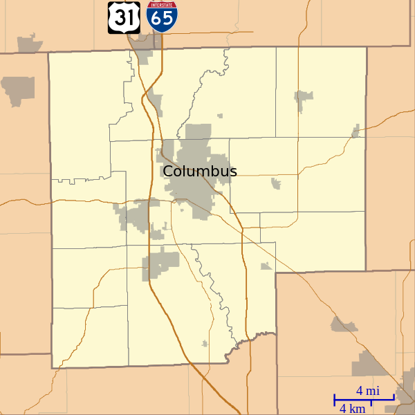
English: This is a map of Bartholomew County, Indiana, USA which includes incorporated settlements, township borders, and major highways. |
| التاريخ | |
| المصدر | My own work, using custom-written MapScript applications with United States Census Bureau data |
| المؤلف | Omnedon |
ترخيص
| أنا، مالِك حقوق تأليف ونشر هذا العمل، أجعله في النِّطاق العامِّ، يسري هذا في أرجاء العالم كلِّه. في بعض البلدان، قد يكون هذا التَّرخيص غيرَ مُمكنٍ قانونيَّاً، في هذه الحالة: أمنح الجميع حق استخدام هذا العمل لأي غرض دون أي شرط ما لم يفرض القانون شروطًا إضافية. |
تاريخ الملف
اضغط على زمن/تاريخ لرؤية الملف كما بدا في هذا الزمن.
| زمن/تاريخ | صورة مصغرة | الأبعاد | مستخدم | تعليق | |
|---|---|---|---|---|---|
| حالي | 14:26، 15 سبتمبر 2012 | | 768 × 768 (192 كيلوبايت) | Omnedon | == {{int:filedesc}} == {{Information |Description={{en|This is a map of Bartholomew County, Indiana, USA which includes incorporated settlements, township borders, and major highways.}} |Source=My own work, using cust... |
استخدام الملف
الصفحة التالية تستخدم هذا الملف:
الاستخدام العالمي للملف
الويكيات الأخرى التالية تستخدم هذا الملف:
- الاستخدام في azb.wikipedia.org
- الاستخدام في ceb.wikipedia.org
- الاستخدام في en.wikipedia.org
- North Christian Church
- First Christian Church (Columbus, Indiana)
- Irwin Conference Center
- First Baptist Church (Columbus, Indiana)
- Mabel McDowell Adult Education Center
- McKinley School (Columbus, Indiana)
- Azalia, Indiana
- Burnsville, Indiana
- Corn Brook, Indiana
- Garden City, Indiana
- Grammer, Indiana
- Newbern, Indiana
- Ogilville, Indiana
- North Ogilville, Indiana
- Nortonburg, Indiana
- Old Saint Louis, Indiana
- Petersville, Indiana
- Rosstown, Indiana
- Rugby, Indiana
- Saint Louis Crossing, Indiana
- Stony Lonesome, Indiana
- Waymansville, Indiana
- Waynesville, Indiana
- Walesboro, Indiana
- Mount Healthy, Indiana
- Miller House (Columbus, Indiana)
- Hope Historic District (Hope, Indiana)
- Module:Location map/data/USA Indiana Bartholomew County/doc
- Jewell Village, Indiana
- McEwen-Samuels-Marr House
- Haw Creek Leather Company
- Columbus Historic District (Columbus, Indiana)
- Elnora Daugherty Farm
- William R. Gant Farm
- Newsom–Marr Farm
- D. W. Heagy Farm
- David Aikens House
- James Marr Farm
- New Hope Bridge
- Pugh Ford Bridge
- Module:Location map/data/USA Indiana Bartholomew County
- The Republic Newspaper Office
اعرض المزيد من الاستخدام العام لهذا الملف.