
ملف:Sahara dust plume Nov 1998.jpg

حجم هذه المعاينة: 800 × 567 بكسل. الأبعاد الأخرى: 320 × 227 بكسل | 640 × 454 بكسل | 1٬024 × 726 بكسل | 1٬280 × 908 بكسل | 2٬560 × 1٬816 بكسل | 4٬449 × 3٬156 بكسل.
الملف الأصلي (4٬449 × 3٬156 بكسل حجم الملف: 5٫06 ميجابايت، نوع MIME: image/jpeg)
| هذا ملف من ويكيميديا كومنز. معلومات من صفحة وصفه مبينة في الأسفل. كومنز مستودع ملفات ميديا ذو رخصة حرة. |
ملخص
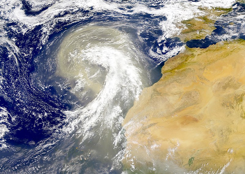
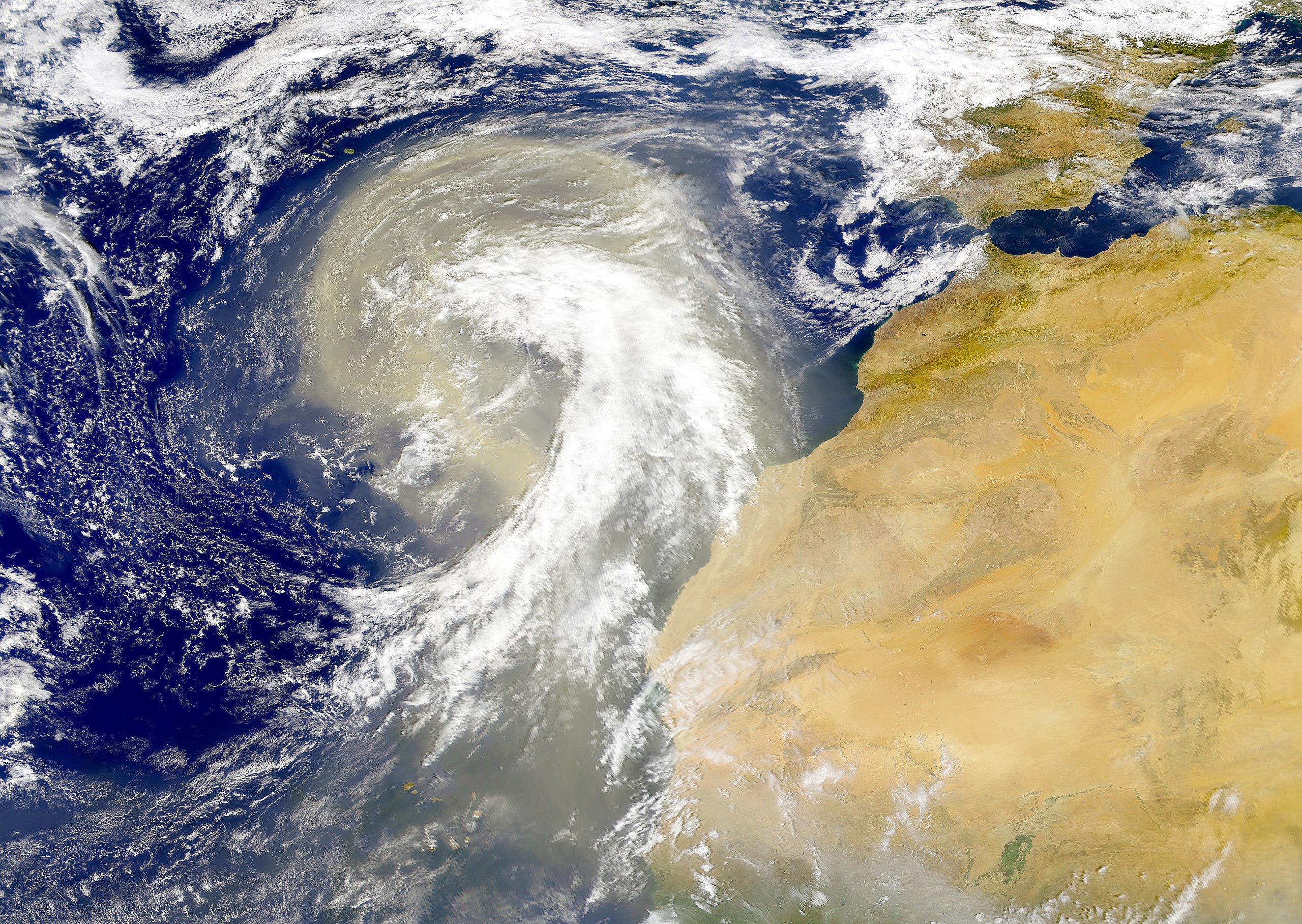
| الوصف | Dust plume off the Sahara desert over the northeast Atlantic Ocean. The Azores are visible at the northwest edge of the dust plume in this SeaWiFS image. The Cape Verde Islands can be seen through the dust near the bottom of the image. Sensor: OrbView-2/SeaWiFS |
| التاريخ | |
| المصدر | NASA Visible Earth |
| المؤلف | Provided by the SeaWiFS Project, NASA/Goddard Space Flight Center, and ORBIMAGE |
ترخيص
| This image is from the Sea-viewing Wide Field-of-view Sensor (SeaWiFS) Project and more than 5 years old.
Satellite data captured by the SeaWIFS sensor are released into the public domain 5 years after capture. Data less than five years old can be re-used only for educational or scientific purposes; any commercial use of such images must be coordinated with GeoEye. [1] |
| This work has been released into the public domain by its copyright holder, GeoEye. This applies worldwide. في بعض البلدان، قد يكون هذا التَّرخيص غيرَ مُمكنٍ قانونيَّاً، في هذه الحالة: يمنح GeoEye الجميع حق استخدام هذا العمل لأي غرض دون أي شرط ما لم يفرض القانون شروطًا إضافية.
|
تاريخ الملف
اضغط على زمن/تاريخ لرؤية الملف كما بدا في هذا الزمن.
| زمن/تاريخ | صورة مصغرة | الأبعاد | مستخدم | تعليق | |
|---|---|---|---|---|---|
| حالي | 00:01، 6 نوفمبر 2005 | | 4٬449 × 3٬156 (5٫06 ميجابايت) | Tintazul | {{Information| |Description=Dust plume off the Sahara desert over the northeast Atlantic Ocean. The Azores are visible at the northwest edge of the dust plume in this SeaWiFS image. The Cape Verde Islands can be seen through the dust near the bottom of th |
استخدام الملف
الصفحة التالية تستخدم هذا الملف:
الاستخدام العالمي للملف
الويكيات الأخرى التالية تستخدم هذا الملف:
- الاستخدام في ast.wikipedia.org
- الاستخدام في azb.wikipedia.org
- الاستخدام في ca.wikipedia.org
- الاستخدام في en.wikipedia.org
- الاستخدام في en.wikivoyage.org
- الاستخدام في eo.wikipedia.org
- الاستخدام في es.wikipedia.org
- الاستخدام في fa.wikipedia.org
- الاستخدام في ga.wikipedia.org
- الاستخدام في hu.wikipedia.org
- الاستخدام في ko.wikipedia.org
- الاستخدام في lt.wikipedia.org
- الاستخدام في lv.wikipedia.org
- الاستخدام في ml.wikipedia.org
- الاستخدام في uk.wikipedia.org
- الاستخدام في vi.wikipedia.org
- الاستخدام في www.wikidata.org