
ملف:Skyros Satellite.jpg
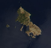
Skyros_Satellite.jpg (170 × 161 بكسل حجم الملف: 29 كيلوبايت، نوع MIME: image/jpeg)
| هذا ملف من ويكيميديا كومنز. معلومات من صفحة وصفه مبينة في الأسفل. كومنز مستودع ملفات ميديا ذو رخصة حرة. |
Forming the southern tip of the Balkan Peninsula, Greece is made up of a series of mountains that run into the sea, extending into scattered islands through the Aegean Sea in the east. The texture of mountain and valley makes the country appear marbled in tan and green in this true-color image, captured by the Moderate Resolution Imaging Spectroradiometer (MODIS) on NASA’s Terra satellite on August 19, 2004. The bright green areas in the center and right side of the peninsula are likely agricultural areas. The green is lighter in tone than the native dark vegetation that grows in ragged lines along the mountain ranges. The grey and tan pock marks within the agricultural areas are small cities. Greece’s largest city and capital, Athens, forms a large grey smudge on the southern tip of the mainland peninsula.
Modern-day Greece is a nation of many islands, but in ancient times, Greece was a loose confederation of city-states that usually only came together as a whole to defend themselves from invaders. With easy access to the Mediterranean Sea to the south and the Aegean Sea to the north and northeast, Athens was among the most powerful of the city states.
More recently, Athens has again become the center of the world’s attention as the Olympic Games returned to their modern birthplace in August 2004. The ancient Games began in 776 BCE in the city of Olympia on the northwest side of Peloponnesus, the large island immediately below the mainland, just west of Athens. About 2,700 years later, in 1896, the Olympics were reborn in Athens. The 2004 Olympics mark the twenty-eighth modern Olympiad.
On August 19, skies were clear over Greece and the Balkan States to its north. MODIS detected several fires burning primarily in Bulgaria, Greece’s northeastern neighbor. The fires have are faintly outlined in red. The high-resolution image provided above has a resolution of 250 meters per pixel. It is available in additional resolutions.
NASA image courtesy Jeff Schmaltz, MODIS Land Rapid Response Team at NASA GSFC
Source: NASA نسخة مؤرشفة at the Wayback Machine
| يقع هذا العمل في النِّطاق العامّ في الولايات المُتحدة الأمريكيَّة لأَنَّه عملٌ خالِصٌ من إِنتاج وكالة الفضاء الأمريكيَّة. تنصُ حقوق التَّأليف والنَّشر الخاصَّة بوكالة الفضاء الأمريكيَّة على أنَّ "أعمال الوكالة غير مَحميَّة بحقوق التَّأليف والنَّشر ما لم يُذكر خلافُ ذلك". لمزيدٍ من المعلومات انظر القالِب {{PD-USGov}} وصفحة حقوق التَّأليف والنَّشر الخاصَّة بالوكالة وصفحة سياسة الصُّور الخاصَّة بمُختبر الدَّفع النَّفَّاث. | ||
 |
تنبيهات:
|

تاريخ الملف
اضغط على زمن/تاريخ لرؤية الملف كما بدا في هذا الزمن.
| زمن/تاريخ | صورة مصغرة | الأبعاد | مستخدم | تعليق | |
|---|---|---|---|---|---|
| حالي | 18:35، 25 أغسطس 2018 | | 170 × 161 (29 كيلوبايت) | MarginalCost | File:Satellite image of Greece.jpg cropped 95 % horizontally, 96 % vertically using CropTool with lossless mode. |
استخدام الملف
الصفحتان التاليتان تستخدمان هذا الملف:
الاستخدام العالمي للملف
الويكيات الأخرى التالية تستخدم هذا الملف:
- الاستخدام في en.wikipedia.org
- الاستخدام في hyw.wikipedia.org
- الاستخدام في it.wikipedia.org
- الاستخدام في mk.wikipedia.org
- الاستخدام في sk.wikipedia.org
- الاستخدام في ta.wikipedia.org