
ملف:Accreting coast Image6.svg

حجم معاينة PNG لذلك الملف ذي الامتداد SVG: 800 × 377 بكسل. الأبعاد الأخرى: 320 × 151 بكسل | 640 × 301 بكسل | 1٬024 × 482 بكسل | 1٬280 × 602 بكسل | 2٬560 × 1٬205 بكسل | 1٬481 × 697 بكسل.
الملف الأصلي (ملف SVG، أبعاده 1٬481 × 697 بكسل، حجم الملف: 15 كيلوبايت)
| هذا ملف من ويكيميديا كومنز. معلومات من صفحة وصفه مبينة في الأسفل. كومنز مستودع ملفات ميديا ذو رخصة حرة. |
ملخص
| الوصف |
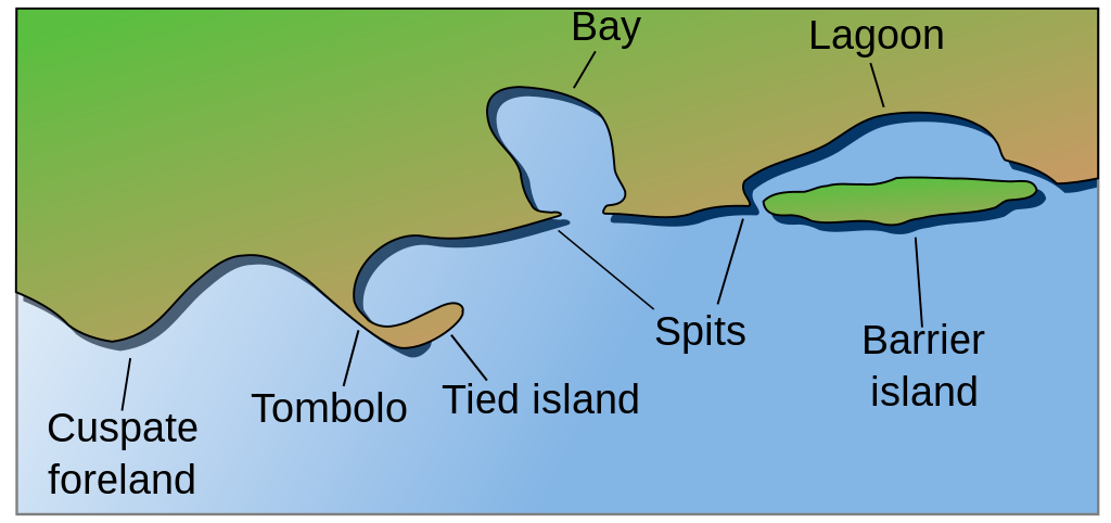
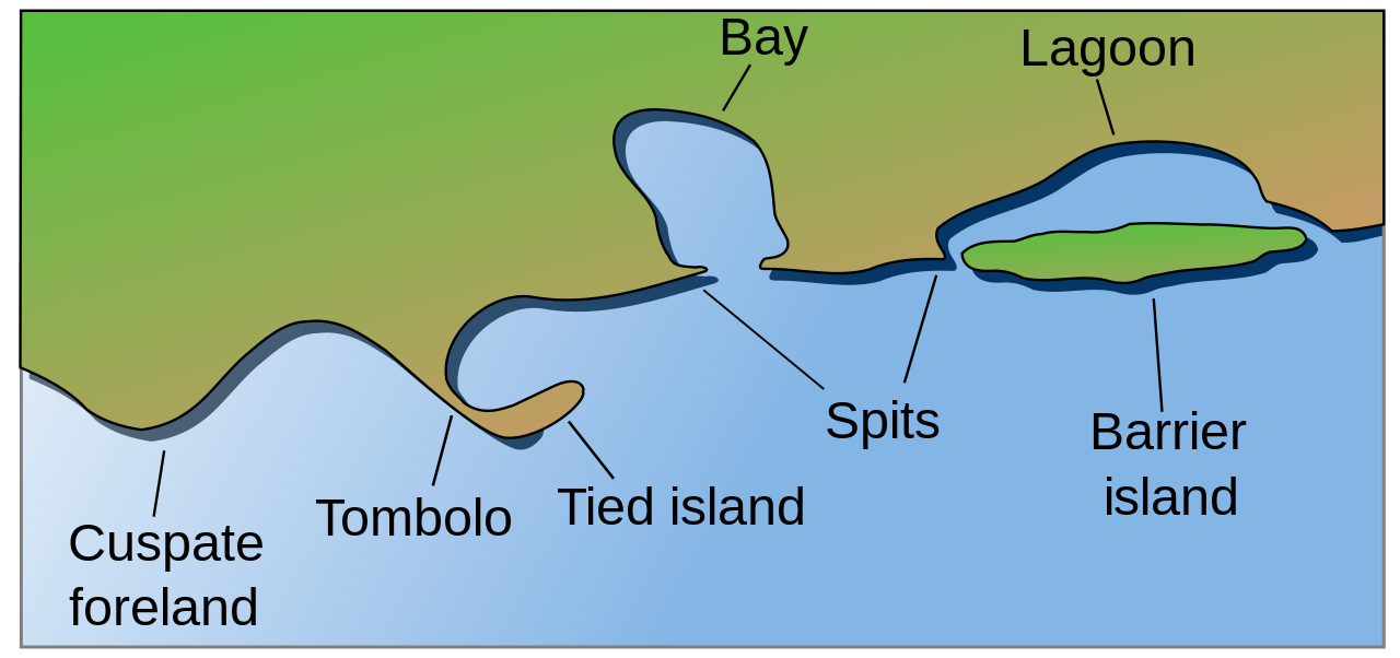
English: Coastal and oceanic landforms. Cuspate foreland, tombolo, spit, bay, lagoon, barrier island. |
| التاريخ | |
| المصدر | self-made SVG, based on the public domain PNG Accreting coast Image6.png by Feydey |
| المؤلف | Surachit |
| إصدارات أخرى |
أَعمالٌ مُشتقَّة مِن هذا الملفِّ: Accreting coast Image6-ta.svg
|
| SVG منشأ الملف | الشيفرة المصدرية لهذا الرسم المتجه صالحة. , or with something else.هذا الرسم المتجهي أُنشئ بواسطة Inkscape |


ترخيص
| وضع -Feydey-، وهو المؤلف، هذا العمل في النِّطاق العامِّ. يسري ذلك في كل أرجاء العالم. في بعض البلدان، قد يكون هذا التَّرخيص غيرَ مُمكنٍ قانونيَّاً، في هذه الحالة: |
تاريخ الملف
اضغط على زمن/تاريخ لرؤية الملف كما بدا في هذا الزمن.
| زمن/تاريخ | صورة مصغرة | الأبعاد | مستخدم | تعليق | |
|---|---|---|---|---|---|
| حالي | 04:17، 16 مايو 2022 | | 1٬481 × 697 (15 كيلوبايت) | Bacon Noodles | Fixed background (water) alignment |
| 01:49، 12 فبراير 2018 |  | 1٬481 × 697 (15 كيلوبايت) | Howpper | Added tied island. A Tombolo is what connects a Tied island to the mainland, so it would be exclusive to not include both features. | |
| 21:48، 16 أغسطس 2007 |  | 1٬481 × 697 (13 كيلوبايت) | Surachit | {{Information |Description=Coastal and oceanic landforms. Cuspate foreland, tombolo, spit, bay, lagoon, barrier island. |Source=self-made SVG, based on the public domain PNG [http://en.wikipedia.org/wiki/Image:Accreting_coast_Image6.png] by [http://en.wik |
استخدام الملف
الصفحة التالية تستخدم هذا الملف:
الاستخدام العالمي للملف
الويكيات الأخرى التالية تستخدم هذا الملف:
- الاستخدام في az.wikipedia.org
- الاستخدام في bh.wikipedia.org
- الاستخدام في chr.wikipedia.org
- الاستخدام في cs.wikipedia.org
- الاستخدام في en.wikipedia.org
- Archipelago
- Coast
- Dune
- Island
- Islands of the Clyde
- List of peninsulas
- Beach
- Fjord
- Atoll
- Strait
- Boulder
- Estuary
- Natural arch
- Lagoon
- Coral reef
- Firth
- Isthmus
- Argyll and Bute
- Firth of Clyde
- Gulf of California
- Coastal erosion
- Talk:Beach
- River delta
- Cliff
- Reef
- Islet
- Salt marsh
- Tombolo
- Stack (geology)
- Cove
- Shoal
- Spit (landform)
- Longshore drift
- Ria
- Barrier island
- Emergent coastline
- Submergent coastline
- Groyne
- Rip current
- Pebble
اعرض المزيد من الاستخدام العام لهذا الملف.