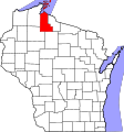
ملف:Map of Wisconsin highlighting Ashland County.svg
المظهر

حجم معاينة PNG لذلك الملف ذي الامتداد SVG: 560 × 600 بكسل. الأبعاد الأخرى: 224 × 240 بكسل | 448 × 480 بكسل | 717 × 768 بكسل | 956 × 1٬024 بكسل | 1٬912 × 2٬048 بكسل | 1٬055 × 1٬130 بكسل.
الملف الأصلي (ملف SVG، أبعاده 1٬055 × 1٬130 بكسل، حجم الملف: 70 كيلوبايت)
تاريخ الملف
اضغط على زمن/تاريخ لرؤية الملف كما بدا في هذا الزمن.
| زمن/تاريخ | صورة مصغرة | الأبعاد | مستخدم | تعليق | |
|---|---|---|---|---|---|
| حالي | 10:44، 25 يونيو 2024 |  | 1٬055 × 1٬130 (70 كيلوبايت) | Nux | fix rendering (remove clipping) |
| 00:21، 13 فبراير 2006 |  | 4٬747 × 5٬087 (103 كيلوبايت) | David Benbennick | {{subst:User:Dbenbenn/clm|county=Ashland County|state=Wisconsin|type=county}} | |
| 18:13، 12 فبراير 2006 |  | 4٬747 × 5٬087 (103 كيلوبايت) | David Benbennick | {{subst:User:Dbenbenn/clm|county=Ashland County|state=Wisconsin|type=county}} |
استخدام الملف
ال18 صفحة التالية تستخدم هذا الملف:
- آشلاند (ويسكونسن)
- أجندا (ويسكونسن)
- أشلاند (ويسكونسن)
- باترنات (ويسكونسن)
- بيكسفيل (ويسكونسن)
- جاكوبز (ويسكونسن)
- سانبورن (ويسكونسن)
- شاناغولدن (ويسكونسن)
- شبوا (ويسكونسن)
- غوردون (مقاطعة آشلاند)
- غينغليس (ويسكونسن)
- لا بوينت (ويسكونسن)
- مارينغو (ويسكونسن)
- مقاطعة آشلاند (ويسكونسن)
- مورس (ويسكونسن)
- ميلين (ويسكونسن)
- وايت ريفر (ويسكونسن)
- قالب:مقاطعة آشلاند (ويسكونسن)
الاستخدام العالمي للملف
الويكيات الأخرى التالية تستخدم هذا الملف:
- الاستخدام في bg.wikipedia.org
- الاستخدام في bpy.wikipedia.org
- الاستخدام في cdo.wikipedia.org
- الاستخدام في ceb.wikipedia.org
- الاستخدام في ce.wikipedia.org
- الاستخدام في cy.wikipedia.org
- الاستخدام في de.wikipedia.org
- الاستخدام في en.wikipedia.org
- List of counties in Wisconsin
- Ashland County, Wisconsin
- Agenda, Wisconsin
- Butternut, Wisconsin
- Chippewa, Wisconsin
- Gingles, Wisconsin
- Gordon, Ashland County, Wisconsin
- Jacobs, Wisconsin
- La Pointe, Wisconsin
- Marengo, Wisconsin
- Mellen, Wisconsin
- Morse, Wisconsin
- Odanah, Wisconsin
- Peeksville, Wisconsin
- Sanborn, Wisconsin
- Shanagolden, Wisconsin
- White River, Wisconsin
- Ashland (town), Wisconsin
- Ashland, Wisconsin
- Bad River Band of the Lake Superior Tribe of Chippewa Indians
- La Pointe County, Wisconsin
- Manitou Island (Wisconsin)
- Michigan Island
- Long Island (Wisconsin)
- Hermit Island (Wisconsin)
- Cat Island (Wisconsin)
- Bear Island (Wisconsin)
- Madeline Island
- Template:Ashland County, Wisconsin
- Glidden, Wisconsin
- Stockton Island
- Outer Island (Wisconsin)
- Oak Island (Wisconsin)
- Otter Island (Wisconsin)
- Rocky Island (Wisconsin)
- Ironwood Island (Wisconsin)
- South Twin Island (Wisconsin)
- North Twin Island (Wisconsin)
- Chequamegon Point
اعرض المزيد من الاستخدام العام لهذا الملف.
