
ملف:Mexico Chihuahua location map.svg

حجم معاينة PNG لذلك الملف ذي الامتداد SVG: 532 × 600 بكسل. الأبعاد الأخرى: 213 × 240 بكسل | 426 × 480 بكسل | 681 × 768 بكسل | 908 × 1٬024 بكسل | 1٬817 × 2٬048 بكسل | 2٬176 × 2٬453 بكسل.
الملف الأصلي (ملف SVG، أبعاده 2٬176 × 2٬453 بكسل، حجم الملف: 805 كيلوبايت)
| هذا ملف من ويكيميديا كومنز. معلومات من صفحة وصفه مبينة في الأسفل. كومنز مستودع ملفات ميديا ذو رخصة حرة. |
W3C-validity not checked.
| الوصف |
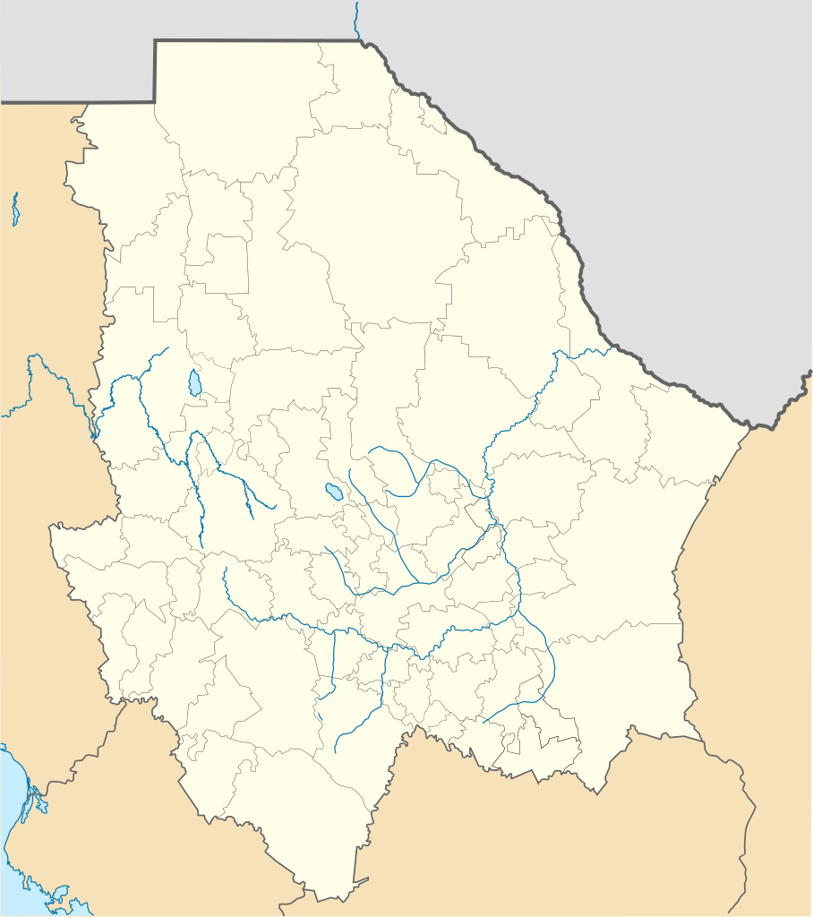
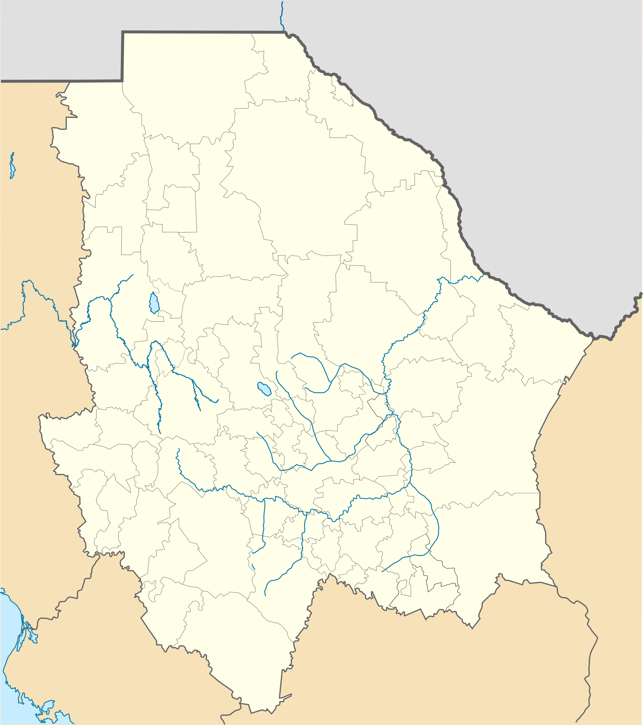
Location Map of Chihuahua Equirectangular projection, Geographic limits of the map:
|
| التاريخ | |
| المصدر | عمل شخصي |
| المؤلف | Battroid (talk) |
أنا، صاحب حقوق التأليف والنشر لهذا العمل، أنشر هذا العمل تحت الرخصة التالية:
| أنا، مالِك حقوق تأليف ونشر هذا العمل، أجعله في النِّطاق العامِّ، يسري هذا في أرجاء العالم كلِّه. في بعض البلدان، قد يكون هذا التَّرخيص غيرَ مُمكنٍ قانونيَّاً، في هذه الحالة: أمنح الجميع حق استخدام هذا العمل لأي غرض دون أي شرط ما لم يفرض القانون شروطًا إضافية. |
تاريخ الملف
اضغط على زمن/تاريخ لرؤية الملف كما بدا في هذا الزمن.
| زمن/تاريخ | صورة مصغرة | الأبعاد | مستخدم | تعليق | |
|---|---|---|---|---|---|
| حالي | 23:15، 4 نوفمبر 2012 | | 2٬176 × 2٬453 (805 كيلوبايت) | Battroid | {{ValidSVG}} {{Information |Description=Location Map of Chihuahua Equirectangular projection, Geographic limits of the map: * N: 32.03° N * S: 25.45° N * W: 109.47° W * E: 102.82° W |Source={{own work}} |Date=2011-08-21 |Author=[[... |
| 07:06، 5 مارس 2012 |  | 2٬176 × 2٬453 (728 كيلوبايت) | Battroid | {{ValidSVG}} {{Information |Description=Location Map of Chihuahua Equirectangular projection, Geographic limits of the map: * N: 32.03° N * S: 25.45° N * W: 109.47° W * E: 102.82° W |Source={{own work}} |Date=2011-08-21 |Author=[[... | |
| 19:44، 21 أغسطس 2011 |  | 2٬176 × 2٬453 (721 كيلوبايت) | Battroid | {{ValidSVG}} {{Information |Description=Location Map of Chihuahua Equirectangular projection, Geographic limits of the map: * N: 32.03° N * S: 25.45° N * W: 109.47° W * E: 102.82° W |Source={{own work}} |Date=2011-08-21 |Author=[[Use |
استخدام الملف
الصفحة التالية تستخدم هذا الملف:
الاستخدام العالمي للملف
الويكيات الأخرى التالية تستخدم هذا الملف:
- الاستخدام في bg.wikipedia.org
- الاستخدام في ceb.wikipedia.org
- الاستخدام في ce.wikipedia.org
- الاستخدام في de.wikipedia.org
- Chihuahua (Stadt)
- Barranca del Cobre
- Ciudad Juárez
- Nuevo Casas Grandes
- Parral (Chihuahua)
- Ojinaga
- Cuauhtémoc (Chihuahua)
- Wikipedia:Kartenwerkstatt/Positionskarten/Nordamerika
- Estadio Monumental Chihuahua
- Estadio Olímpico Benito Juárez
- Naica
- Creel
- Meoqui
- Vorlage:Positionskarte Mexiko Chihuahua
- Cerro Mohinora
- Nationalpark Cumbres de Majalca
- Batopilas
- Valle de Allende
- Estadio Olímpico Universitario José Reyes Baeza
- Casas Grandes
- الاستخدام في en.wikipedia.org
- Copper Canyon
- Ciudad Juárez
- Parral, Chihuahua
- Ciudad Madera
- Camargo, Chihuahua
- Chihuahua International Airport
- Ciudad Juárez International Airport
- Delicias, Chihuahua
- Batopilas, Chihuahua
- User:Stone/MPS
- Lake Arareco
- Puerto Palomas, Chihuahua
- Batopilas Municipality
- Santa Bárbara, Chihuahua
- Guachochi
- Carichí
- Témoris
- Huejotitán
- Mariano Matamoros, Chihuahua
اعرض المزيد من الاستخدام العام لهذا الملف.