
ملف:St Lucie Inlet aerial view.jpg
حجم هذه المعاينة: 800 × 504 بكسل. الأبعاد الأخرى: 320 × 202 بكسل | 640 × 403 بكسل | 1٬024 × 645 بكسل | 1٬500 × 945 بكسل.
الملف الأصلي (1٬500 × 945 بكسل حجم الملف: 120 كيلوبايت، نوع MIME: image/jpeg)
| هذا ملف من ويكيميديا كومنز. معلومات من صفحة وصفه مبينة في الأسفل. كومنز مستودع ملفات ميديا ذو رخصة حرة. |
| الوصف |
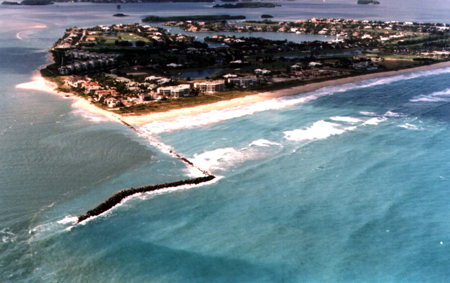
English: Aerial view of Sailfish Point and the St. Lucie Inlet in Martin County, Florida, USA. The inlet is an entrance from the Atlantic Ocean to the Indian River Lagoon and the St. Lucie River. View is to the northwest from over the Atlantic Ocean.
Coordinates: 27°9′58″N 80°9′24″W / 27.16611°N 80.15667°W |
|||
| الموقع | مقاطعة مارتن | |||
| التاريخ | not specified or unknown | |||
| المصدر |
U.S. Army Corps of Engineers Digital Visual Library Image page Image description page Digital Visual Library home page |
|||
| المؤلف | Tony Santana, U.S. Army Corps of Engineers | |||
| الترخيص (إعادة استخدام هذا الملف) |
|
تاريخ الملف
اضغط على زمن/تاريخ لرؤية الملف كما بدا في هذا الزمن.
| زمن/تاريخ | صورة مصغرة | الأبعاد | مستخدم | تعليق | |
|---|---|---|---|---|---|
| حالي | 03:20، 27 أبريل 2007 | | 1٬500 × 945 (120 كيلوبايت) | DanMS | {{Information | Description = {{en|Aerial view of St. Lucie Inlet in Martin County, Florida, USA. The inlet is an entrance from the Atlantic Ocean to the Indian River Lagoon and the city of Port St. Lucie. View is to the northwest from over the Atlanti |
استخدام الملف
الصفحة التالية تستخدم هذا الملف:
الاستخدام العالمي للملف
الويكيات الأخرى التالية تستخدم هذا الملف:
- الاستخدام في ca.wikipedia.org
- الاستخدام في ceb.wikipedia.org
- الاستخدام في ce.wikipedia.org
- الاستخدام في en.wikipedia.org
- الاستخدام في es.wikipedia.org
- الاستخدام في eu.wikipedia.org
- الاستخدام في fa.wikipedia.org
- الاستخدام في fr.wikipedia.org
- الاستخدام في it.wikipedia.org
- الاستخدام في ja.wikipedia.org
- الاستخدام في lld.wikipedia.org
- الاستخدام في pl.wikipedia.org
- الاستخدام في pt.wikipedia.org
- الاستخدام في ru.wikipedia.org
- الاستخدام في sr.wikipedia.org
- الاستخدام في tr.wikipedia.org
- الاستخدام في tt.wikipedia.org
- الاستخدام في uk.wikipedia.org
- الاستخدام في uz.wikipedia.org
- الاستخدام في www.wikidata.org
- الاستخدام في zh-min-nan.wikipedia.org