
ملف:Géorgie (Europe).png

حجم هذه المعاينة: 766 × 600 بكسل. الأبعاد الأخرى: 307 × 240 بكسل | 613 × 480 بكسل | 981 × 768 بكسل | 1٬280 × 1٬002 بكسل | 1٬619 × 1٬268 بكسل.
الملف الأصلي (1٬619 × 1٬268 بكسل حجم الملف: 196 كيلوبايت، نوع MIME: image/png)
| هذا ملف من ويكيميديا كومنز. معلومات من صفحة وصفه مبينة في الأسفل. كومنز مستودع ملفات ميديا ذو رخصة حرة. |
.png)
| الوصف |
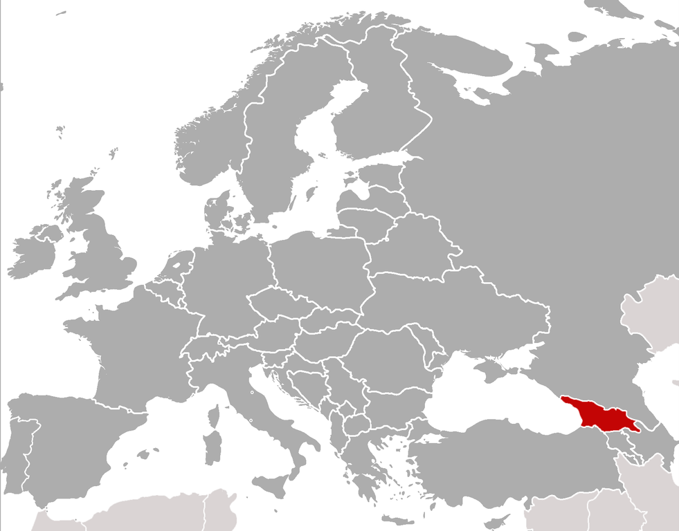
Location of Georgia (rep. in Europe) (Red) Location of Georgia.
(Grey) Europe. |
| التاريخ | (UTC) |
| المصدر | |
| المؤلف |
|
| هذا رسمٌ مُعَدَّلٌ رقميَّاً من النسخة الأصليَّة. التعديلات هي: cropped, added location. يُمكن الاطلاع على النسخة الأصليَّة هنا: BlankMap-Europe-v4.png:
|
أنا، صاحب حقوق التأليف والنشر لهذا العمل، أنشر هذا العمل تحت الرخص التالية:
| هذا الملفُّ مُرخَّص بموجب رخصة المشاع الإبداعي نسبة المُصنَّف إِلى مُؤَلِّفه - المشاركة بالمثل 3.0 العامة | ||
| ||
| تمت إضافة علامة الترخيص لهذا الملف كجزء من رخصة جنو للوثائق الحرة تحديث الترخيص. |

|
يسمح نسخ وتوزيع و/أو تعديل هذه الوثيقة تحت شروط رخصة جنو للوثائق الحرة، الإصدار 1.2 أو أي إصدار لاحق تنشره مؤسسة البرمجيات الحرة؛ دون أقسام ثابتة ودون نصوص أغلفة أمامية ودون نصوص أغلفة خلفية. نسخة من الرخصة تم تضمينها في القسم المسمى GNU Free Documentation License. |
لك أن تختار الرخصة التي تناسبك.
sarxan qaracoplu sarxan qaracoplu
سجلُّ الرَّفع الأصيل
This image is a derivative work of the following images: sarxan qaracoplu*File:BlankMap-Europe-v4.png licensed with Cc-by-sa-3.0-migrated, GFDL
- 2010-02-23T18:00:48Z Maps & Lucy 2100x1525 (131745 Bytes) Fixed the border of Kosovo with Serbia, proportioned British Overseas Cyprus Territories, San Marino, Vatican City, Monacco, and the Spanish Overseas Moroccan Territories, and added Guersney, Jersy, Liechtenstein, and Gibralt
- 2009-03-30T16:12:12Z Cradel 2100x1525 (131867 Bytes) Reverted to version as of 17:12, 8 March 2009
- 2009-03-20T22:20:11Z Avala 2100x1525 (70412 Bytes) what does this map represent? upload an alternative for unofficial views
- 2009-03-08T17:12:32Z Cradel 2100x1525 (131867 Bytes) Reverted to version as of 06:05, 5 April 2008
- 2008-11-20T01:00:56Z Tocino 2100x1525 (70412 Bytes) Reverted to version as of 19:36, 19 March 2008
- 2008-04-05T06:05:34Z Hoshie 2100x1525 (131867 Bytes) added the UK SBAs on Cyprus
- 2008-03-22T21:58:25Z Nightstallion 2100x1525 (131807 Bytes) Reverted to version as of 16:35, 13 March 2008
- 2008-03-19T19:36:48Z Patstuart 2100x1525 (70412 Bytes) Reverted to version as of 18:16, 11 March 2008 - see [[Image talk:BlankMap-World-v6.png#As stated in reversion]]
- 2008-03-13T16:35:26Z Nightstallion 2100x1525 (131807 Bytes) upload a variant if you wish, but the majority in Europe recognises or will recognise.
- 2008-03-11T18:16:50Z Avala 2100x1525 (70412 Bytes) there is no consensus in Europe
- 2008-02-24T02:42:03Z Hoshie 2100x1525 (131807 Bytes) Added Kosovo since it has been internationally recognized
- 2007-05-02T09:05:00Z Roke 2100x1525 (70412 Bytes) better version derived from svg
- 2006-06-26T06:32:12Z Roke 748x546 (27077 Bytes) minor - bottom left box
- 2006-06-26T05:53:48Z Roke 748x546 (27099 Bytes) {{Information |Description= blank map of europe, including north africa and western asia. With french overseas territories shown in inset lower left (French Guiana, Guadeloupe, Martinique, Reunion) |Source= derived from [[:Im
Uploaded with derivativeFX
تاريخ الملف
اضغط على زمن/تاريخ لرؤية الملف كما بدا في هذا الزمن.
| زمن/تاريخ | صورة مصغرة | الأبعاد | مستخدم | تعليق | |
|---|---|---|---|---|---|
| حالي | 22:21، 5 فبراير 2011 | | 1٬619 × 1٬268 (196 كيلوبايت) | ComtesseDeMingrelie | {{Information |Description=Location of Georgia (rep. in Europe) {{legend|#FF0000|'''(Red)''' Location of Georgia.}} {{legend|#808080|'''(Grey)''' Europe.}} |Source=*File:BlankMap-Europe-v4.png |Date=2011-02-05 22:20 (UTC) |Author=*[[: |
استخدام الملف
الصفحتان التاليتان تستخدمان هذا الملف:
الاستخدام العالمي للملف
الويكيات الأخرى التالية تستخدم هذا الملف:
- الاستخدام في als.wikipedia.org
- الاستخدام في bcl.wikipedia.org
- الاستخدام في bjn.wikipedia.org
- الاستخدام في bo.wikipedia.org
- الاستخدام في br.wikipedia.org
- الاستخدام في bs.wikipedia.org
- الاستخدام في incubator.wikimedia.org
- Template:Wn/az/Ölkə xəbərləri-Gürcüstan
- Wn/az/Ermənistanın Gürcüstandakı səfirliyi qarşısında etiraz aksiyası keçirilib
- Wn/az/Bakı-Tbilisi-Qars yeni dəmir yolu xəttində ilk sınaq keçirilib
- Wn/az/Gürcüstanın Cənubi Osetiya Muxtar Vilayətində Türkiyə jurnalistlərinə atəş açılıb
- Wn/az/Çəkiliş vaxtı Mixail Saakaşvilinin xanımına hücum ediblər
.png)