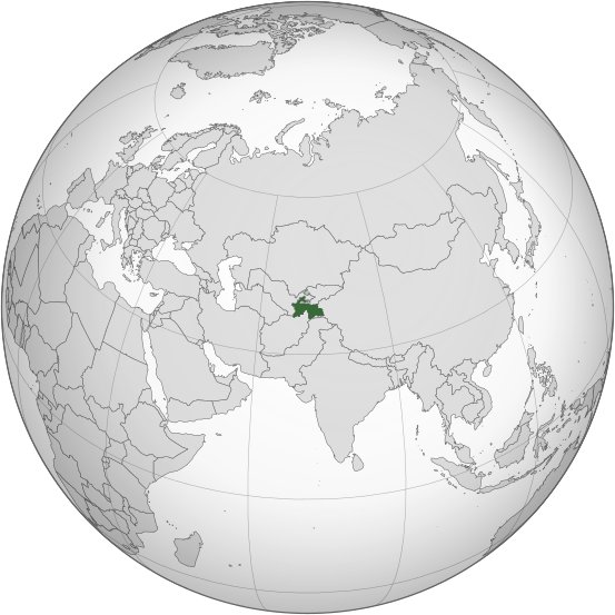
ملف:Tajikistan (orthographic projection).svg

حجم معاينة PNG لذلك الملف ذي الامتداد SVG: 553 × 553 بكسل. الأبعاد الأخرى: 240 × 240 بكسل | 480 × 480 بكسل | 768 × 768 بكسل | 1٬024 × 1٬024 بكسل | 2٬048 × 2٬048 بكسل.
الملف الأصلي (ملف SVG، أبعاده 553 × 553 بكسل، حجم الملف: 304 كيلوبايت)
تاريخ الملف
اضغط على زمن/تاريخ لرؤية الملف كما بدا في هذا الزمن.
| زمن/تاريخ | صورة مصغرة | الأبعاد | مستخدم | تعليق | |
|---|---|---|---|---|---|
| حالي | 23:41، 16 مارس 2015 |  | 553 × 553 (304 كيلوبايت) | Flappiefh | Removed Somaliland and Kosovo. Separated Western Sahara and Morroco. |
| 16:39، 4 أغسطس 2013 |  | 553 × 553 (308 كيلوبايت) | Flappiefh | Added South Sudan. The map is now centered on Tadjikistan. | |
| 09:21، 16 مايو 2011 |  | 550 × 550 (485 كيلوبايت) | Eddo | graphic design? | |
| 16:24، 23 يناير 2011 |  | 107 × 107 (79 كيلوبايت) | RaviC | {{Information |Description={{en|Location of Tajikistan. Taken from [http://www.un.org/Depts/Cartographic/map/profile/tajikist.pdf UN Map]<br/> en:Category:Maps of Tajikistan}} |Source=Transferred from [http://en.wikipedia.org en.wikipedia]; transf |
استخدام الملف
أكثر من 100 صفحة تستخدم هذا الملف. القائمة التالية تعرض فقط أول 100 صفحة تستخدم هذا الملف. قائمة كاملة متوفرة.
- العلاقات الأذربيجانية الطاجيكستانية
- العلاقات الأرجنتينية الطاجيكستانية
- العلاقات الأردنية الطاجيكستانية
- العلاقات الأسترالية الطاجيكستانية
- العلاقات الأفغانية الطاجيكية
- العلاقات الألبانية الطاجيكستانية
- العلاقات الألمانية الطاجيكستانية
- العلاقات الأمريكية الطاجيكية
- العلاقات الأندورية الطاجيكستانية
- العلاقات الأنغولية الطاجيكستانية
- العلاقات الأوزبكستانية الطاجيكية
- العلاقات الإثيوبية الطاجيكستانية
- العلاقات الإريترية الطاجيكستانية
- العلاقات الإستونية الطاجيكستانية
- العلاقات الإسرائيلية الطاجيكستانية
- العلاقات الإماراتية الطاجيكستانية
- العلاقات الإيرانية الطاجيكية
- العلاقات الإيطالية الطاجيكستانية
- العلاقات البالاوية الطاجيكستانية
- العلاقات الباهاماسية الطاجيكستانية
- العلاقات البرازيلية الطاجيكستانية
- العلاقات البرتغالية الطاجيكستانية
- العلاقات البلجيكية الطاجيكستانية
- العلاقات البنمية الطاجيكستانية
- العلاقات البنينية الطاجيكستانية
- العلاقات البوتانية الطاجيكستانية
- العلاقات البوروندية الطاجيكستانية
- العلاقات البولندية الطاجيكستانية
- العلاقات البوليفية الطاجيكستانية
- العلاقات البيلاروسية الطاجيكستانية
- العلاقات التشيكية الطاجيكستانية
- العلاقات التونسية الطاجيكستانية
- العلاقات الجزائرية الطاجيكستانية
- العلاقات الجنوب إفريقية الطاجيكستانية
- العلاقات الجورجية الطاجيكستانية
- العلاقات الدنماركية الطاجيكستانية
- العلاقات الدومينيكانية الطاجيكستانية
- العلاقات الروسية الطاجيكية
- العلاقات الرومانية الطاجيكستانية
- العلاقات الزامبية الطاجيكستانية
- العلاقات الزيمبابوية الطاجيكستانية
- العلاقات الساموية الطاجيكستانية
- العلاقات السريلانكية الطاجيكستانية
- العلاقات السلوفينية الطاجيكستانية
- العلاقات السودانية الطاجيكستانية
- العلاقات السورية الطاجيكستانية
- العلاقات السورينامية الطاجيكستانية
- العلاقات السويسرية الطاجيكستانية
- العلاقات السيراليونية الطاجيكستانية
- العلاقات الطاجيكستانية الغامبية
- العلاقات الطاجيكستانية الغرينادية
- العلاقات الطاجيكستانية الغواتيمالية
- العلاقات الطاجيكستانية الغيانية
- العلاقات الطاجيكستانية الفانواتية
- العلاقات الطاجيكستانية الفيجية
- العلاقات الطاجيكستانية القبرصية
- العلاقات الطاجيكستانية الكازاخستانية
- العلاقات الطاجيكستانية الكمبودية
- العلاقات الطاجيكستانية الكندية
- العلاقات الطاجيكستانية الكوبية
- العلاقات الطاجيكستانية الكورية الجنوبية
- العلاقات الطاجيكستانية الكورية الشمالية
- العلاقات الطاجيكستانية الكوستاريكية
- العلاقات الطاجيكستانية الكونغوية
- العلاقات الطاجيكستانية الكينية
- العلاقات الطاجيكستانية اللاتفية
- العلاقات الطاجيكستانية اللوكسمبورغية
- العلاقات الطاجيكستانية الليبيرية
- العلاقات الطاجيكستانية الليختنشتانية
- العلاقات الطاجيكستانية الليسوتوية
- العلاقات الطاجيكستانية المالاوية
- العلاقات الطاجيكستانية المالية
- العلاقات الطاجيكستانية المصرية
- العلاقات الطاجيكستانية الموزمبيقية
- العلاقات الطاجيكستانية المولدوفية
- العلاقات الطاجيكستانية الميانمارية
- العلاقات الطاجيكستانية الناوروية
- العلاقات الطاجيكستانية النيبالية
- العلاقات الطاجيكستانية النيجيرية
- العلاقات الطاجيكستانية النيكاراغوية
- العلاقات الطاجيكستانية الهندوراسية
- العلاقات العراقية الطاجيكستانية
- العلاقات العمانية الطاجيكستانية
- العلاقات الغابونية الطاجيكستانية
- العلاقات الكاميرونية الطاجيكستانية
- العلاقات الكويتية الطاجيكستانية
- العلاقات المارشالية الطاجيكستانية
- العلاقات المجرية الطاجيكستانية
- العلاقات المغربية الطاجيكستانية
- العلاقات المكسيكية الطاجيكستانية
- العلاقات الهندية الطاجيكية
- العلاقات الوسط إفريقية الطاجيكستانية
- العلاقات اليابانية الطاجيكستانية
- العلاقات اليمنية الطاجيكستانية
- طاجيكستان
- قائمة الدول ذات السيادة والأقاليم التابعة في آسيا
- معاملة المثليين في طاجيكستان
- بوابة:العالم الإسلامي
- بوابة:العالم الإسلامي/دولة مختارة/29
- بوابة:العالم الإسلامي/دولة مختارة/أرشيف
عرض المزيد من الوصلات إلى هذا الملف.
الاستخدام العالمي للملف
الويكيات الأخرى التالية تستخدم هذا الملف:
- الاستخدام في ace.wikipedia.org
- الاستخدام في ady.wikipedia.org
- الاستخدام في af.wikipedia.org
- الاستخدام في als.wikipedia.org
- الاستخدام في ami.wikipedia.org
- الاستخدام في arz.wikipedia.org
- الاستخدام في ast.wikipedia.org
- الاستخدام في as.wikipedia.org
- الاستخدام في av.wikipedia.org
- الاستخدام في ay.wikipedia.org
- الاستخدام في azb.wikipedia.org
- الاستخدام في az.wikipedia.org
- الاستخدام في az.wiktionary.org
- الاستخدام في bat-smg.wikipedia.org
- الاستخدام في ba.wikipedia.org
- الاستخدام في bcl.wikipedia.org
- الاستخدام في be-tarask.wikipedia.org
- الاستخدام في be.wikipedia.org
- الاستخدام في bg.wikipedia.org
- الاستخدام في bh.wikipedia.org
- الاستخدام في bn.wikipedia.org
- الاستخدام في bn.wikivoyage.org
- الاستخدام في bo.wikipedia.org
- الاستخدام في bpy.wikipedia.org
- الاستخدام في bs.wikipedia.org
- الاستخدام في ca.wikipedia.org
- الاستخدام في cdo.wikipedia.org
- الاستخدام في ceb.wikipedia.org
- الاستخدام في ce.wikipedia.org
- الاستخدام في chr.wikipedia.org
- الاستخدام في ckb.wikipedia.org
- الاستخدام في crh.wikipedia.org
- الاستخدام في cs.wikipedia.org
- الاستخدام في cu.wikipedia.org
- الاستخدام في cv.wikipedia.org
- الاستخدام في da.wikipedia.org
- الاستخدام في de.wikipedia.org
- الاستخدام في diq.wikipedia.org
- الاستخدام في dsb.wikipedia.org
- الاستخدام في dty.wikipedia.org
- الاستخدام في dv.wikipedia.org
- الاستخدام في ee.wikipedia.org
- الاستخدام في el.wikipedia.org
- الاستخدام في en.wikipedia.org
اعرض المزيد من الاستخدام العام لهذا الملف.

