
ملف:Port Austin Michigan aerial view.jpg
حجم هذه المعاينة: 800 × 560 بكسل. الأبعاد الأخرى: 320 × 224 بكسل | 640 × 448 بكسل | 1٬024 × 717 بكسل | 1٬280 × 896 بكسل | 1٬500 × 1٬050 بكسل.
الملف الأصلي (1٬500 × 1٬050 بكسل حجم الملف: 602 كيلوبايت، نوع MIME: image/jpeg)
| هذا ملف من ويكيميديا كومنز. معلومات من صفحة وصفه مبينة في الأسفل. كومنز مستودع ملفات ميديا ذو رخصة حرة. |
| الوصف |
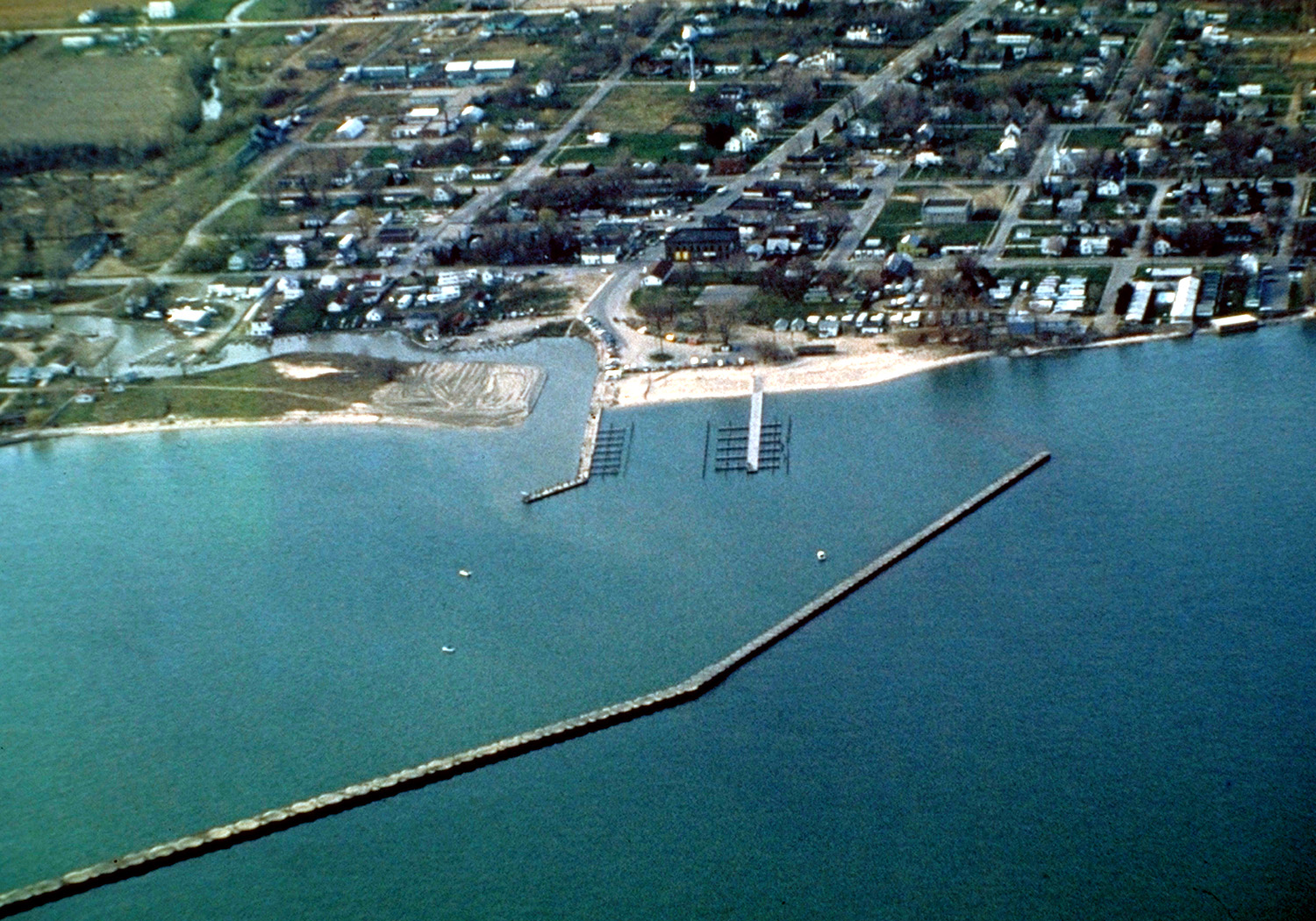
English: Aerial view of Port Austin, Michigan, USA. The city lies on the northeast edge of Saginaw Bay on Lake Huron. |
|||
| التاريخ | not specified or unknown | |||
| المصدر |
U.S. Army Corps of Engineers Digital Visual Library Image page Image description page Digital Visual Library home page |
|||
| المؤلف | U.S. Army Corps of Engineers, photographer not specified or unknown | |||
| الترخيص (إعادة استخدام هذا الملف) |
|
|||
| الموقع | Port Austin, Huron County, Michigan, USA |
| موقع الكاميرا | | هذه وغيرها من الصور في مواقعها على: خريطة الشارع المفتوحة |
|---|
تاريخ الملف
اضغط على زمن/تاريخ لرؤية الملف كما بدا في هذا الزمن.
| زمن/تاريخ | صورة مصغرة | الأبعاد | مستخدم | تعليق | |
|---|---|---|---|---|---|
| حالي | 01:43، 30 مارس 2007 | | 1٬500 × 1٬050 (602 كيلوبايت) | DanMS | {{Information | Description = {{en|Aerial view of Port Austin, Michigan, USA. The city lies on the northeast edge of Saginaw Bay on Lake Huron.}} | Source = U.S. Army Corps of Engineers Digital Visual Library<br />[http://images.usace.army.mil/ |
استخدام الملف
لا توجد صفحات تستخدم هذا الملف.
الاستخدام العالمي للملف
الويكيات الأخرى التالية تستخدم هذا الملف:
- الاستخدام في ceb.wikipedia.org
- الاستخدام في nl.wikipedia.org
- الاستخدام في simple.wikipedia.org
- الاستخدام في sr.wikipedia.org
- الاستخدام في zh-min-nan.wikipedia.org