
ملف:Maglic.jpg

حجم هذه المعاينة: 800 × 600 بكسل. الأبعاد الأخرى: 320 × 240 بكسل | 640 × 480 بكسل | 1٬024 × 768 بكسل.
الملف الأصلي (1٬024 × 768 بكسل حجم الملف: 212 كيلوبايت، نوع MIME: image/jpeg)
| هذا ملف من ويكيميديا كومنز. معلومات من صفحة وصفه مبينة في الأسفل. كومنز مستودع ملفات ميديا ذو رخصة حرة. |
| موقع الكاميرا | | هذه وغيرها من الصور في مواقعها على: خريطة الشارع المفتوحة |
|---|
| الوصف |
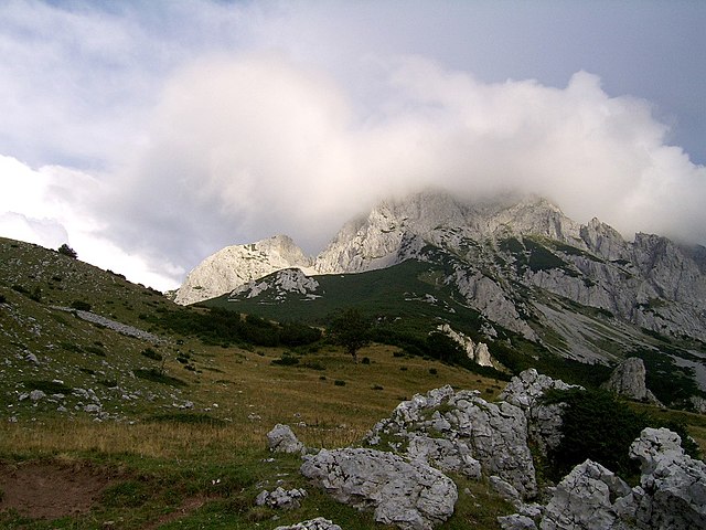
English: Maglić - the highest peak of Bosnia&Herzegovina Polski: Maglić - najwyższy szczyt Bośni i Hercegowiny Bosanski: Maglić - najviši planinski vrh Bosne i Hercegovine Українська: Гора Маґлич, Боснія та Герцеговина |
| التاريخ | |
| المصدر | عمل شخصي |
| المؤلف | Radosław Botev |
| الترخيص (إعادة استخدام هذا الملف) |
This image is copyrighted by Radosław Botev. Permission is granted to use this picture freely for any purpose - whether commercial or not - and to make derivative works provided that the copyright holder's full name is quoted. You are also hereby permitted to redistribute this file and its derivations to a third party under any license of your choice as long as that license requires attribution to the copyright holder of this work and does not allow to ever revoke that requirement (possible examples are Creative Commons Attribution or GFDL). This shall by no means limit the right of the redistributor of this work or the right of the derivative works' creators to impose other restrictions on the use or further redistribution of this work or its derivations. English français polski +/- |
أنا، صاحب حقوق التأليف والنشر لهذا العمل، أنشر هذا العمل تحت الرخصة التالية:

|
يَسمَح حامل حقوق هذا الملف لأيٍّ كان باستخدامه لأيِّ غرضٍ، بشرط نسبة المُصنَّف إِلى حامِل الحقوق بشكلٍ سليمٍ. إِنَّ إعادة التوزيع واشتقاق أعمال أخرى مِن هذا الأَصل والاستعمال التِّجاريُّ والاستعمالات الأُخرى جميعها مَسمُوحة. |
|
|
English: This file was originally published under one of the following licenses: Creative Commons Attribution ShareAlike 2.5 Poland or Creative Commons Attribution 2.5 Poland and was later relicensed by its creator Radosław Botev. The current license is less restrictive and still permits the use of this image under the original license. Polski: Ten plik był pierwotnie opublikowany na jednej z następujących licencji: Creative Commons Uznanie Autorstwa - Na tych samych warunkach 2.5 Polska lub Creative Commons Uznanie Autorstwa 2.5 Polska. Twórca tej pracy Radosław Botev zmienił później licencję. Obecna licencja jest mniej restrykcyjna i wciąż zezwala na wykorzystanie tej grafiki na zasadach przewidzianych w pierwotnej licencji.
|
تاريخ الملف
اضغط على زمن/تاريخ لرؤية الملف كما بدا في هذا الزمن.
| زمن/تاريخ | صورة مصغرة | الأبعاد | مستخدم | تعليق | |
|---|---|---|---|---|---|
| حالي | 09:50، 13 سبتمبر 2006 | | 1٬024 × 768 (212 كيلوبايت) | Botev | {{Information |Description=Sutjeska National Park |Source= |Date=September, 2006 |Author=Botev |Permission=own work |other_versions= }} |
استخدام الملف
الصفحتان التاليتان تستخدمان هذا الملف:
الاستخدام العالمي للملف
الويكيات الأخرى التالية تستخدم هذا الملف:
- الاستخدام في azb.wikipedia.org
- الاستخدام في be.wikipedia.org
- الاستخدام في bg.wikipedia.org
- الاستخدام في bs.wikipedia.org
- الاستخدام في cs.wikipedia.org
- الاستخدام في de.wikipedia.org
- الاستخدام في eo.wikipedia.org
- الاستخدام في es.wikipedia.org
- الاستخدام في fa.wikipedia.org
- الاستخدام في fr.wikipedia.org
- الاستخدام في gl.wikipedia.org
- الاستخدام في hr.wikipedia.org
- الاستخدام في id.wikipedia.org
- الاستخدام في it.wikipedia.org
- الاستخدام في lmo.wikipedia.org
- الاستخدام في lt.wikipedia.org
- الاستخدام في mk.wikipedia.org
- الاستخدام في mt.wikipedia.org
- الاستخدام في nl.wikipedia.org
- الاستخدام في no.wikipedia.org
- الاستخدام في pl.wikipedia.org
- الاستخدام في pt.wikipedia.org
- الاستخدام في roa-rup.wikipedia.org
- الاستخدام في ro.wikipedia.org
- الاستخدام في ru.wikipedia.org
- الاستخدام في sh.wikipedia.org
- الاستخدام في sq.wikipedia.org
- الاستخدام في sq.wikibooks.org
- الاستخدام في sr.wikipedia.org
- الاستخدام في uk.wikipedia.org
- الاستخدام في vi.wikipedia.org
- الاستخدام في www.wikidata.org